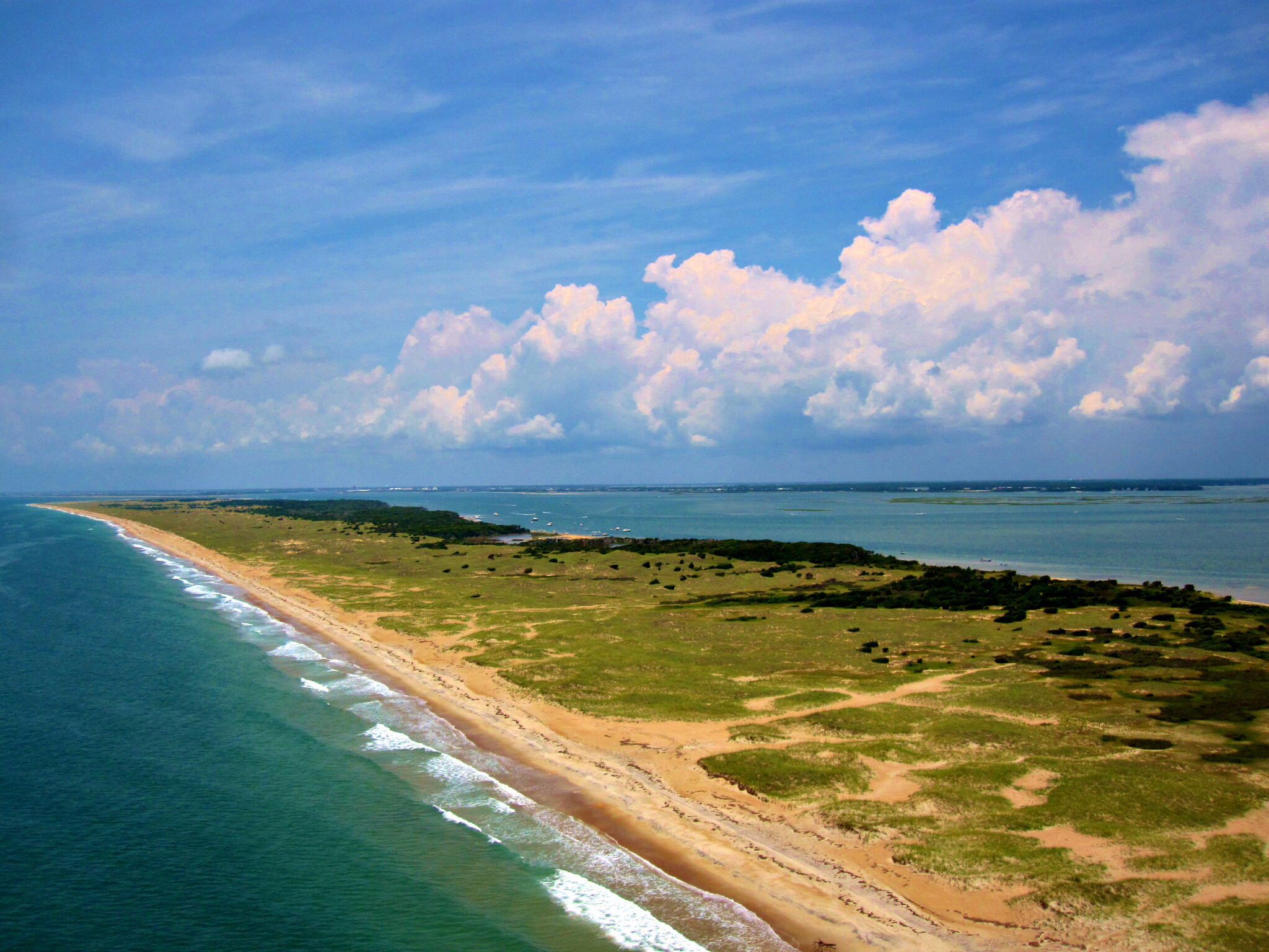
North Core Banks

🔴 LOW RESEARCH VOLUME
Camp template
LOCATION
Shackleford Banks
NPS archive photo, no ownership or location data.

🟢 HIGH RESEARCH VOLUME
Armtec
LOCATION
Portsmouth Village–established by Edward Armfield, Sr.
Previously owned by T.T. Potter, of Beaufort.
Destroyed by Hurricanes Floyd and Dorian.

🔴 LOW RESEARCH VOLUME
Atlantic Gun Club Company, Inc.
LOCATION
North Core Banks, north of Horse Island and near Sand Island and the Charlotte Outing Club property
Herman S. Crossman, Greenwich, Conn. 1927
🔴 LOW RESEARCH VOLUME
Avon Mason Camps
LOCATION
North Core Banks, “north of site of Morris Camps”
12 cabins for fishermen (no current photo).

🟢 HIGH RESEARCH VOLUME
Battle Boys Camp
LOCATION
North Core Banks, Sheep Island–one mile SW of Portsmouth Village
c. 1945 Salter-Battle Hunting and Fishing Lodge

🔴 LOW RESEARCH VOLUME
Beacon Island Lodge
LOCATION
Beacon Island, Ocracoke Inlet, Township of Portsmouth.
Captain Bill Gaskill, owner established prior to 1918. Floyd Simmons hunted here in the 20s.

🟡 MEDIUM RESEARCH VOLUME
Berkley Machine Works
LOCATION
Holdings in or near Portsmouth Village (no structure yet known exist)–hence, no photos
Sam Jones of Virginia and Ocracoke Village was head of this company.

🟡 MEDIUM RESEARCH VOLUME
Billy & Janice Smith
LOCATION
North Core Banks, -one mile south of Morris Fishing Camps, north of Drum Inlet
-built before 1970, lease from U.S. in 1983, lease expired with death of Ms. Smith after 2020

🔴 LOW RESEARCH VOLUME
Blanchard Lupton
LOCATION
North Core Banks, Evergreens
No photo currently available
Son of John Lupton, often hunted with Clay Fulcher.

🔴 LOW RESEARCH VOLUME
Brant Rock Rod and Gun Club
LOCATION
Portsmouth Village, Lifesaving Station lease
Leased from early 1950s til 1966.

🔴 LOW RESEARCH VOLUME
“Brother” and Manly Gaskill
LOCATION
North Core Banks, creekside south of Evergreens, built in the 70s in the area hunted by their family for years

🔴 LOW RESEARCH VOLUME
Bruce Willet Camp
LOCATION
Seen on left, next to Billy Smith Camp, just south of the Don Morris Camps
Structurally, “like a home,” it was destroyed (?how) decades before the Smith lease concluded.
🔴 LOW RESEARCH VOLUME
Calvin Lupton Camp
LOCATION
North Core Banks, on a creek northeast of Whalebone Island
Camp was a small version of a house trailer up against a tree–used for hunting (no photo).
🔴 LOW RESEARCH VOLUME
Carey Slough Camp
LOCATION
NE of Morris Camps, North Core Banks
Recalled by Clay Fulcher, but no ownership memory (no data or photo currently).

🟡 MEDIUM RESEARCH VOLUME
Casey’s Island Camp
LOCATION
North Core Banks, Casey’s Island, north of Portsmouth

🟡 MEDIUM RESEARCH VOLUME
Charles & Cindy Styron
LOCATION
North Core Banks, Wib’s Creek Community, north of the Morris fishing camps
–established post WWII, 70s?
Sammy Nelson had built the family camp originally.
🔴 LOW RESEARCH VOLUME
Charles Clifton Edwards Camp
LOCATION
North Core Banks, at “the Swash” Inlet area–positioned on the last creek before the Swash
Fred Cox shared with Sr. and Jr. Edwards–built up on the dunes (no photo).
🔴 LOW RESEARCH VOLUME
Charles Smith Camp
LOCATION
North Core Banks, Whalebone Inlet
(no photo)
“On a lump out from Whalebone Inlet”–a nicer house with screened-in porch–down below Kenny Daniels Camp.

🟢 HIGH RESEARCH VOLUME
Charlie Vellines
LOCATION
Portsmouth Village
1960s–leased ther CG Station
BLOG READ: Fabulous Flying Fishermen

🔴 LOW RESEARCH VOLUME
Charlotte Outing Club
LOCATION
North Core Banks, Sand Island
Sept. 2, 1914 til 1930
Ownership data is all that is available at this time.

🟢 HIGH RESEARCH VOLUME
Clay & June Fulcher
LOCATION
North Core Banks, Wib’s Creek community
Known as the “little camp.”
Lloyd Mason was prior owner.

🔴 LOW RESEARCH VOLUME
Coast Guard Mounted Beach Patrol
LOCATION
Portsmouth
WWII
🔴 LOW RESEARCH VOLUME
Darryl Hill Houseboat
LOCATION
Darryl kept a houseboat just behind the Clifton
He was caught in the “Christmas Blizzard there. (no photos)
🔴 LOW RESEARCH VOLUME
David Willis Camp
LOCATION
North Core Banks, Portsmouth
Established prior to 1979
Morehead City resident (No photo of camp currently available).
Hunted from a pit blind on Shell Island and other sites.

🔴 LOW RESEARCH VOLUME
Delmas Willis
LOCATION
North Core Banks, ?Portsmouth Village
Location unconfirmed–photo from NPS Archives

🔴 LOW RESEARCH VOLUME
Dick Smith Camp
LOCATION
“At or near the Cricket Islands” and near the Sand Islands, North Core Banks
Established in late 60s or early 70s–for hunting and family recreation.
🔴 LOW RESEARCH VOLUME
Don “Donnie” Russell Camp
LOCATION
North Core Banks, “on there other side of the Evergreens”
“was there before 1956”

🔴 LOW RESEARCH VOLUME
Dr. Kendall’s Houseboat
LOCATION
Wib’s Creek, North Core Banks
A part of the Wib’s community, he hunted with them and kept his boat tied north of the creek dock.

🔴 LOW RESEARCH VOLUME
Dump Island-Mike Mason Camp
LOCATION
Island at edge of Drum Inlet formed from dredge spoils when Inlet was created
Owned initially by Mike Mason, and subsequently by son Andy.
🔴 LOW RESEARCH VOLUME
Earl Hamilton Camp
LOCATION
North Core Banks, “at the edge of the marsh up there creek from the Battle Boy’s camp” (No photo)
“Way up the creek and built like a house with a hipped roof”–his son Richard was a long-hauler and could bring his boat right up to the camp”

🟢 HIGH RESEARCH VOLUME
Earl Noe Camp
LOCATION
Portsmouth Village, Doctor’s Creek
Earl Noe, Sr., Earl Mac Noe, Clifton Noe
Earl, Sr. had leased an earlier camp in the village/this structure had been used earlier by Armtec.

🔴 LOW RESEARCH VOLUME

🟡 MEDIUM RESEARCH VOLUME
🔴 LOW RESEARCH VOLUME
Farmer Styron, Lester Day, and Leroy Goodwin
LOCATION
North Core Banks, across Three Hat Creek, NE of the Evergreens north island
Used for hunting–all three were from Cedar Island (no photo)

🟡 MEDIUM RESEARCH VOLUME
Floyd Simmons
LOCATION
Portsmouth–1920s
Floyd hunted and guided based in Portsmouth often–as well as Beacon Island.
This photo of an unidentified house is from his archives.

🟡 MEDIUM RESEARCH VOLUME
Fortin Island Camp
LOCATION
North Core Banks, Fortin Island
D. M. Philemon of Charlotte listed as owner.

🟡 MEDIUM RESEARCH VOLUME
Freddie Hooper Camp
LOCATION
Wib’s Creek, North Core Banks–cabin nearest head of creek
Had been owned by Winky Robinson.

🟢 HIGH RESEARCH VOLUME
Fulcher Family Camp
LOCATION
North Core Banks, between Wib’s Creek and site of The Pilentary
Nick-named “Pilentary”-recognizing the family connection to the historic camp and also called “the big camp” since Clay and June had a smaller camp at Wib’s Creek.

🔴 LOW RESEARCH VOLUME
George Hill’s Cabin
LOCATION
North Core, Wib’s Creek area, second camp area on north side of dirt road
Destroyed in the 1933 storm, the chimney base is all that remains–Hill’s cabin here preceded all others–the Fulcher “little camp” sat on this property.
🔴 LOW RESEARCH VOLUME
Harold Daniels Camp
LOCATION
North Core Banks, Whalebone Island
On top of a hill, tiny structure with hipped roof–Harold could run his boat to the camp shore/Kenny Wayne Daniels, son, shared the camp (no photo)

🔴 LOW RESEARCH VOLUME
Henry Kirk/James Taylor Camp
LOCATION
Four miles south of Portsmouth at head of Evergreen Slough, one creek north of Evergreens (No Photo)
Both from Beaufort–used camp for hunting.

🔴 LOW RESEARCH VOLUME
Henry Pigott
LOCATION
Portsmouth Village, Doctor’s Creek–
last male resident of Portsmouth (center)
Seasonally, Henry cooked for hunters, occasionally guided and also made some decoys.

🟡 MEDIUM RESEARCH VOLUME
High Hills Camp
LOCATION
North Core Banks, Whalebone Island
Second camp of Judge Lambert Morris, (first was victim to arson), purchased by Pat Patterson and Mark Smith.

🟡 MEDIUM RESEARCH VOLUME
Hill’s Hornet’s Nest
LOCATION
North Core Banks, north marsh of Sheep Island
Originally built by Ross Salter and its 9.6 acres abutted original Salter Gun Club property–Bobby Hill succeeded Ross.

🔴 LOW RESEARCH VOLUME
Horse Island Camp–unidentified
LOCATION
North Core Banks, Horse Island–on Harry Davis property
No other data currently available.
🔴 LOW RESEARCH VOLUME
Hugh Styron Camp
LOCATION
North Core Banks, High Hills area, south the Salter Family Camp
Source: Len Norman Salter (no photo)
🔴 LOW RESEARCH VOLUME
Hunting Club -?Lyons Club
LOCATION
Between Wib’s and Morris Camps, North Core Banks
Clay Fulcher remembered it there, “a small affair”–no photo or other data currently.

🟡 MEDIUM RESEARCH VOLUME
Ira & Don Morris Camps
LOCATION
North Core Banks, about 4 miles north of the then-Drum Inlet
Ira Morris brought the first of these camps over in 1936, Morris had a dock and some facilities at the inlet also.

🟡 MEDIUM RESEARCH VOLUME
Jack Rose’s Camp
LOCATION
The fourth camp up the road at Wib’s Creek, North Core Bank
Obtained a 25-year lease due to valid lease in force from Madge Nelson.

🟢 HIGH RESEARCH VOLUME
James Mason
LOCATION
1859 and later, purchased North Core grants from State –multiple tracts–one for his home and later became the Pilentary Club (centered on Swimming Creek)
Worked his schooner from the area–a central family for area.
🔴 LOW RESEARCH VOLUME
James Ray Willis Camp
LOCATION
Wib’s Creek community, north of Don Morris Camps, North Core
Next to June and Clay Fulcher’s “little camp.”
🔴 LOW RESEARCH VOLUME
Darrell Willis Camp
LOCATION
North Core Banks, Wib’s
Very little historical or photographic history.
🔴 LOW RESEARCH VOLUME
Jimmy Chadwick
LOCATION
Along Uncle Billy’s Creek, south of Portsmouth and NE of the Salter Camp (No Photo)
Source: Len Norman Salter
Purchased from Cedar Islanders who had originally built it but were not using it–burned by the Park Service.
🔴 LOW RESEARCH VOLUME
John & Sydney Wallace
LOCATION
On north end of Sheep Island
Lived there till the 1933 storm destroyed their homesite–relocated to Atlantic (no photo).

🟡 MEDIUM RESEARCH VOLUME
Lambert Morris-original camp
LOCATION
North Core Banks, High Hills-Whalebone Island
Destroyed by arson, likely in response to judicial action toward arsonist.

🔴 LOW RESEARCH VOLUME
PORTSMOUTH VILLAGE LEASES
LOCATION
Portsmouth Village, North Core Banks
Several structures were leased for small fees in return for commitment for upkeep.

🔴 LOW RESEARCH VOLUME
Lloyd & Alice Nelson Camp
LOCATION
Wib’s Creek Community, North /Core Banks–second camp on road, at site of George Hill’s earlier cabin
Built by them in 1962, purchased by Clay and June Fulcher later (this photo taken during Fulcher ownership).

🔴 LOW RESEARCH VOLUME
Long Rock Club, Inc.
LOCATION
Portsmouth Village and Big Marsh
–established prior to 1963, held 69 acres
Comprised of hunters primarily from the Lenoir County area.
No photos currently available.
🔴 LOW RESEARCH VOLUME
Melvin Styron Camp
LOCATION
Across the creek at Merkel Hammock NE of Stuart Daniels–built in the 60s–positioned on the first high ground north of the Swash (no photo)
A commercial fisherman from Atlantic/Cedar Island.

🔴 LOW RESEARCH VOLUME
Montford Nelson Camp
LOCATION
North Core Banks–currently undefined location
Madge Nelson had land holdings which included the Wib’s Creek area that she leased for camps there.
No other data–photo from NPS survey–in archives.

🔴 LOW RESEARCH VOLUME
Monnie Nelson Camp
LOCATION
Wib’s Creek area, North Core Banks
Joe Fulcher hunted here as a youth and later.
Built in 1961-62.
🔴 LOW RESEARCH VOLUME
Neal Daniels Camp
LOCATION
North Core Banks, Katherine Jane Islands
Neal, Robert Bruce, Edwin Ricky and Sam Daniels–on a ridge above the mud flats–part of a cluster of camps–destroyed by accidental fire (no photo).

🔴 LOW RESEARCH VOLUME
Pike’s Hammock, Lawrence Pike
LOCATION
Just south of the Pilentary Club site, 1976 map shows square structure designation along the creek
Pike’s property was purchased by Theodore Rogers and structures moved to the Pilentary site.

🟢 HIGH RESEARCH VOLUME
The Pilentary
LOCATION
North Core Banks, just south of Swimming Creek
1859–land purchase-James Mason
1896–Theodore Rogers established
Jordan Mott purchased after Rogers death, sold to Robert Lassiter.
Destroyed in the 1933 un-named storm.

🟡 MEDIUM RESEARCH VOLUME
Portsmouth Lifesaving Station
LOCATION
Portsmouth Village
1956-1964 | After decommissioned, was purchased by Henry Holt and Roy Eubanks of Beaufort–including 12 acres
Sold to Willie York of Raleigh.

🔴 LOW RESEARCH VOLUME
Rams Club-Camp
LOCATION
North Core Banks, near Fortin Island
Listed as “Rams Club”, “on Harry Davis property”–NPS aerial survey–no other data currently available.

🔴 LOW RESEARCH VOLUME
Raymond and Benny Styron
LOCATION
High Grass Island, High Hills Creek
Currently no information available except for their Cedar Island residence.
🔴 LOW RESEARCH VOLUME
Richard Hamilton Camp
LOCATION
North Core Banks, near Evergreens, “across from Julian Hamilton’s camp”
Destroyed by fire. Hamilton had a “ferry” called the Sadie (No photo).
🔴 LOW RESEARCH VOLUME
Ronald Goodwin Camp
LOCATION
North Core Banks, Katherine Jane Islands
From Cedar Island (no photo or other data).
🔴 LOW RESEARCH VOLUME
Royce Emory Camp
LOCATION
North Core Banks, Katherine Jane Islands
Closer to the creek than Neal Daniels and the other camps, on a ridge–used for hunting-the other camps were farther from the creek (no photo).

🟡 MEDIUM RESEARCH VOLUME
Salter Family Camp
LOCATION
North Core Banks, southern Sheep Island
Second camp replacing the structures and land sold to the Battles–built prior to 1971.
🔴 LOW RESEARCH VOLUME
Sammy Salter Camp
LOCATION
Between Wib’s and the Fulcher “big camp,” North Core
“Fashioned out of a bread truck” and placed next to the marsh in 60s or earlier (no photo).

🔴 LOW RESEARCH VOLUME
The Scotch Bonnet
LOCATION
North Core Banks, alongside Bruce Willet and Billy Smith Camps–just south of Morris Camps
Ownership??–photo from NPS archives.
🟡 MEDIUM RESEARCH VOLUME
Stuart Daniels Camp
LOCATION
South side of Merkel Hammock–built in the 60s
Primary use was for fishing. Elmo Gaskill often joined him there to fish. Camp was shared with ?Piner of Williamson.
The camp was burned by the NPS (no photo).

🔴 LOW RESEARCH VOLUME
Unidentified Camp
LOCATION
North Core Banks
From NPS aerial survey–no ownership data available.

🔴 LOW RESEARCH VOLUME
Unidentified Camp
LOCATION
North Core Banks, 17.7 miles North of the (then) Drum Inlet
No current information on this red camp structure.

🔴 LOW RESEARCH VOLUME
Unidentified Camp
LOCATION
North Core (NPS structure survey)
No data currently available–described as being “on a truck.”

🔴 LOW RESEARCH VOLUME
Unidentified Camp
LOCATION
2.6 miles north of Drum Inlet and 0.4 miles south of the Morris Camps, North Core Banks
8-17-70 photo by NPS, center cabin a ruin and end cabins in use (no current ownership data).

🔴 LOW RESEARCH VOLUME
Unidentified Camp
LOCATION
North Core Banks
Aerial survey photo by NPS, no ownership data currently available.

🔴 LOW RESEARCH VOLUME
Unidentified Camp
LOCATION
North Core Banks
NPS aerial survey–no ownership data currently available.

🔴 LOW RESEARCH VOLUME
Unidentified Camp
LOCATION
North Core Banks
NPS aerial survey from archives–no ownership data currently available.

🔴 LOW RESEARCH VOLUME
Unidentified Structures
LOCATION
North Core Banks
From NPS structure survey, in archives without other data.

🔴 LOW RESEARCH VOLUME
Unidentified Tan Cabin
LOCATION
North Core Banks, 15.4 miles North of (then) Drum Inlet
No current information. Yellow Privy.
Photo from Park Service photo survey in their archives.

🔴 LOW RESEARCH VOLUME
Walter Mason Camps
LOCATION
North Core Banks, south of Morris Camps and Billy Smith camp
He ran a fishing camp at this or near this site (no other current data).

🔴 LOW RESEARCH VOLUME
Wilbur Nelson Rental Cabins
LOCATION
At Wib’s Creek, closest to the ocean, North Core (to the right in photo and nearest the ocean)
Five shed roof structures as lodging for fishermen–positioned along the ridge.
🔴 LOW RESEARCH VOLUME
Willis Houseboat
LOCATION
Houseboat used for a camp by Eugene and Monroe Willis, near Sammy Salters Camp (north of Wib’s Creek)
Used primarily for hunting, but also family recreation, they kept a car on the Banks as well (no photos).

🔴 LOW RESEARCH VOLUME
Winky Robinson Camp
LOCATION
Wib’s Creek area, 1-2 miles north of the Morris Camps, North Core
His was one of the first cabins in the area and sat nearest the head of the creek–later bought by Freddy Hooper.

🔴 LOW RESEARCH VOLUME
WOODHOUSE’S DUNES
LOCATION
North Core Banks
7-14-71 aerial structure survey-NPS-labeled Dr. Woodhouse’s dunes–north of Drum Inlet

South Core Banks

🔴 LOW RESEARCH VOLUME
Abandoned Cabins
LOCATION
South Core Banks, mile marker 19.7 and 20.4
Survey photo April 1969—no ownership information.

🔴 LOW RESEARCH VOLUME
Alfred Gaskill Camp
LOCATION
South Core Banks, Great Island Creek
One of many “peeler camps” but this camp was the last to remain into the 60s—no photo.

🟡 AVERAGE RESEARCH VOLUME
Algier Willis Camps
LOCATION
South Core Banks, Great Island
🟢 HIGH RESEARCH VOLUME
Clinton Piner Camp
LOCATION
South Core Banks, just north of Quentin and Burgess
Floated an Airstream trailer and placed on a high dune—Sammy Salter shared the trailer with him.
🔴 LOW RESEARCH VOLUME
C. H. Davis Camp
LOCATION
South Core Banks, Johnson’s Creek 1-2 rooms with screen porch, used for “mullet fishing” (currently, no photo).

🔴 LOW RESEARCH VOLUME
Camps north of Gun Club property
LOCATION
South Core Banks, Harry Davis Property—cluster of 3 buildings, 2 wells and 11 cars (limited info)

🟡 AVERAGE RESEARCH VOLUME
Carlie Willis Fishing Camps
LOCATION
South Core Banks, Great Island
Willis had at least 9 structures.
🔴 LOW RESEARCH VOLUME
Carol and Charlie Brown Camp
LOCATION
South Core Banks
Likely a peeler camp before WW II.
🔴 LOW RESEARCH VOLUME
Clifton Styron Camp
LOCATION
South Core Banks, on Swash Creek—”about mid-way up the creek”
Remembered by Doily Fulcher, was used for duck hunting (no photo).

🔴 LOW RESEARCH VOLUME
Clinton Lewis lands
LOCATION
South Core Banks, north of Station #189

🔴 LOW RESEARCH VOLUME

🟢 HIGH RESEARCH VOLUME
Core Banks Club—Carteret Rod and Gun Club
LOCATION
South Core Banks, 1,027 acres—north of Head of the Hole
Established 1902.

🟡 AVERAGE RESEARCH VOLUME
Davis Island Fishing Foundation
LOCATION
South Core Banks, earlier on North Core—this group of fishermen fished here in the 1930s onward
In 1956, some of the group established a camp at Great Island.

🔴 LOW RESEARCH VOLUME
Drum Inlet
LOCATION
South Core Banks, mile marker 22.0
“New” Drum Inlet just after detonation of 26 tons of dynamite—Corps of Engineers Dec 12, 1971.

🔴 LOW RESEARCH VOLUME

🔴 LOW RESEARCH VOLUME
Eldon Willis/Elmer Salter Camp
LOCATION
South Core Banks, off Grass Lump Creek, behind Big Marsh (no photo currently)

🟡 AVERAGE RESEARCH VOLUME
Elmer Salter Camp
LOCATION
South Core Banks, mile marker 28.3, at head of creek near Horse Island
Family seen here without Elmer in photo, camp was alongside Monroe Nelson’s.
🔴 LOW RESEARCH VOLUME
Fred Willis Camp
LOCATION
South Core Banks, on Great Island Bay
Earl and Janice Fulcher would go with him during the WW II years.
🔴 LOW RESEARCH VOLUME
Hamlin Davis
LOCATION
South Core Banks
Had a “mullet shack” on the Banks for shelter—shelter from weather when fishing (no current photo or other information).

🔴 LOW RESEARCH VOLUME
Homer Fulcher Camp
LOCATION
South Core Banks, across the creek from Willis/Salter camp—behind Big Marsh
No photo currently.
🔴 LOW RESEARCH VOLUME
Homer Fulcher Camp
LOCATION
South Core Banks, Great Island Creek
Likely a peeler camp before WW II.

🔴 LOW RESEARCH VOLUME
Horse Island Camps—NPS photo
LOCATION
South Core Banks, Horse Island
Doily Fulcher remembers J.T. Lewis camp and camp of Ted and Ivey Willis at head of creek at Horse Island.
🔴 LOW RESEARCH VOLUME
J. T. Lewis Camp
LOCATION
South Core Banks, head of creek at Horse Island—took over Elmer Salter’s camp
Doily Fulcher remembers the camp in the 50s.
🔴 LOW RESEARCH VOLUME
James Styron’s Camp
LOCATION
South Core Banks, on Johnson’s Creek
Built in the 40s.
🔴 LOW RESEARCH VOLUME
Joe Guthrie Camp
LOCATION
South Core Banks, on Johnson’s Creek
No photo or other information available.

🔴 LOW RESEARCH VOLUME
John L. Smith Camp
LOCATION
South Core Banks, 1918 fishing camp near C.G. Station #189
There is a “John Smith Creek” near Station #189. Photo is of John Smith’s log books.

🟡 AVERAGE RESEARCH VOLUME
Marvin Murphy Camps
LOCATION
South Core Banks, Great Island area
One of several fishing camps in this area.

🟡 AVERAGE RESEARCH VOLUME
Monroe Nelson Camp
LOCATION
South Core Banks, mile marker 28.3, just yards north of Elmer Salter camp at head of creek at Horse Island
Eldon Willis (left) visiting Monroe at Nelson camp.
🔴 LOW RESEARCH VOLUME
Peeler Camps
LOCATION
South Core Banks, Great Island Creek and further south north of lighthouse
In the 20s, 30s, and 40s but most were gone in the 50s (no photos).

🔴 LOW RESEARCH VOLUME
Philemon Camp
LOCATION
South Core Banks, located near Fortin Island—on Harry Davis property
D. M. Philemon, Charlotte NC.

🟡 AVERAGE RESEARCH VOLUME
Private Camp on Station #189 site
LOCATION
South Core Banks, mile marker 22
🔴 LOW RESEARCH VOLUME
Braxton Piner Camp
LOCATION
South Core Banks, about a mile north of Monroe Nelson camp
Burgess Piner also used camp (no current photo).
🟡 AVERAGE RESEARCH VOLUME
The Ram Club
LOCATION
South Core Banks, Great Island Creek on the north mouth of creek
Built in the 40s or early 50s//Mike Fulcher, Novie Pittman, Dennis Pittman, Homer Fulcher, Earl Gaskill, Billy Pittman, Barry Fulcher, Lloyd Hill, Norman Robinson.
🔴 LOW RESEARCH VOLUME
Reclusive Lady
LOCATION
South Core Banks, north of and near Station #189
During the 50s and 60s, Joyce Mason recalls a reclusive lady from Atlantic—little else is known about her.

🔴 LOW RESEARCH VOLUME
Robert Humber/Cecil Morris Property
LOCATION
South Core Banks, mile marker 22.5 to 24

🔴 LOW RESEARCH VOLUME
Sea Haven—Flake/Powell
LOCATION
South Core Banks, on Harry Davis property, north of the Gun Club line—in cluster of 3 buildings, 2 wells, 11 cars

🔴 LOW RESEARCH VOLUME
Steeps Point Camp—”The Taylor House”
LOCATION
South Core Banks, built on Gutter Creek
Taylor sold the camp to the Kittrells.

🟡 AVERAGE RESEARCH VOLUME
Sterling Robinson’s Camp
LOCATION
South Core Banks, along the shore of Drum Inlet—farthest north of South Core camps
Built in the 50s from surplus materials from Atlantic Air Station—1961 photo.

🟡 AVERAGE RESEARCH VOLUME
Sterling Dixon Camps
LOCATION
South Core Banks, Great Island
Earliest of ferries and cabins for fishermen.
🔴 LOW RESEARCH VOLUME
Styron-Alligood Camp
LOCATION
South Core Banks, Johnson’s Creek
Charlie Aligood, Dickie Styron, David and Mildred Munden, Elizabeth Styron Ritche (currently, no photo).

🟡 AVERAGE RESEARCH VOLUME
Surf Fishing
LOCATION
North and South Core Banks
Active from late 1800 as a sport for visitors, a continuing attraction today.
🔴 LOW RESEARCH VOLUME
Ted and Ivey Willis Camp
LOCATION
South Core Banks, Horse Island at head of creek
Recalled by Doily Fulcher.

🔴 AVERAGE RESEARCH VOLUME
🔴 LOW RESEARCH VOLUME
Tucker Smith Camp
LOCATION
South Core Banks, High Hills
From Smyrna (currently, no photo).

🔴 LOW RESEARCH VOLUME
Unidentified Camp
LOCATION
South Core Banks, north of Gun Club property in cluster of 3 camps—#7,9,10 and 11—Harry Davis property

🔴 LOW RESEARCH VOLUME
Unidentified Camp
LOCATION
South Core Banks, on Harry Davis property, north of Gun Club
#12 on NPS survey.

🔴 LOW RESEARCH VOLUME
Unidentified Camp
LOCATION
South Core Banks, Harry Davis property north of Gun Club line—#13
🔴 LOW RESEARCH VOLUME

🔴 LOW RESEARCH VOLUME
?Willis Fishing Camp
LOCATION
South Core Banks, likely in Great Island area (without identifying info)
🔴 LOW RESEARCH VOLUME
Harry and Julia Willis Camp
LOCATION
South Core Banks, on Deep Pond Creek—south of Johnson’s Creek
From Davis Shore (currently, no photo).
🔴 LOW RESEARCH VOLUME
Charlie and Frank Pake Camp
LOCATION
South Core Banks, Deep Pond Creek (“Deer Pond Creek” by some)
From Smyrna and Marshallberg (currently, no photo).
🔴 LOW RESEARCH VOLUME
J.M. (Morton) Davis lands
LOCATION
South Core Banks, High Hills Islands
Two tracts—60 and 26 acres (currently, no photo).
🔴 LOW RESEARCH VOLUME
Henry L. Willis lands
LOCATION
South Core Banks, inshore and between the High Hills Islands
13 acres—(currently, no photo).
🔴 LOW RESEARCH VOLUME
Headon and Robert Willis Camp
LOCATION
South Core Banks, north side of High Hills, along the creek
There were two camps at same site, one in 1911 and one in 1941 (currently, no photo).
🔴 LOW RESEARCH VOLUME
Fred Fulcher Camp
LOCATION
South Core Banks, High Hills
From Davis Shore (currently, no photo).
🔴 LOW RESEARCH VOLUME
J. D. Potter lands
LOCATION
South Core Banks, head of Horsepen Creek, two islands
13-plus acres (currently, no photo).

🟡 AVERAGE RESEARCH VOLUME
J. Morton Davis Camp—”SEAGIRT”
LOCATION
South Core Banks, Horsepen Creek
First camp burned, camp rebuilt and later, moved nearby.

🔴 LOW RESEARCH VOLUME
George A. Lewis—”Lewis Boys”
LOCATION
South Core Banks, Horsepen Creek
4 acres—6 structures and road to dock—fishermen camps for hire (currently, no photo).
🔴 LOW RESEARCH VOLUME
Earl V. Davis Camps
LOCATION
South Core Banks, Horsepen Creek
5 structures as fishing camps, 8-12 acres?—Margaret Davis owned and leased to James Davis (currently, no photo).
🔴 MODERATE RESEARCH VOLUME
Robert Lee Humber holdings
LOCATION
South Core Banks, near Horsepen Point
Humber had several parcels along the Banks—no structures and “bought with conservation interests” (currently, no photo).
🔴 LOW RESEARCH VOLUME
Lewis Creek Camp
LOCATION
South Core Banks, headwaters of Lewis Island (called Lewis Creek by locals
Pilings of an old camp oceanward from and north of Earl V. Davis 26 acres (no photo).

🔴 LOW RESEARCH VOLUME
Peeler Camp Site—suspected
LOCATION
South Core Banks, near Lewis Island
At the head of a straight-cut channel through the marsh to a wooded ridge—Lewis Woods.
🔴 LOW RESEARCH VOLUME
Thomas Clifford and Leland Willis Camp
LOCATION
South Core Banks, inshore of the mouth of Lewis Creek
T. Clifford 1877-1963—(currently, no photo).

🔴 LOW RESEARCH VOLUME
Iredell Lewis Camp
LOCATION
South Core Banks, Lewis Creek
Crab work camp in use prior to the 60s (Grayer Keith Willis photo).
🔴 LOW RESEARCH VOLUME
Deck Murphy Camp
LOCATION
South Core Banks, Zack’s Creek
(Currently, no photo or historical data).

🔴 LOW RESEARCH VOLUME
Van Willis Camp
LOCATION
South Core Banks, Lewis Creek
(Photo and info from Grayer Keith Willis) 1881-1961 Van Willis—”crabbers” worked this area likely back to early 1900s.

🔴 LOW RESEARCH VOLUME
Delmas Lewis Camp
LOCATION
South Core Banks, Horsepen Creek
Delmas’ camp was alongside Morton Davis’ SEAGIRT—photo is of Lewis’ fish house on mainland.

🔴 LOW RESEARCH VOLUME
Will, Cisro and Ray Davis Camp
LOCATION
South Core Banks, Lewis Creek
Their first “crab camp” was built in the 1920s (Keith Grayer Willis info and photo).

🔴 LOW RESEARCH VOLUME
Unidentified Camp
LOCATION
South Core Banks, 5.9 miles north of the lighthouse
Accessible only from the sound—sits on Robert Humber property(?)—NPS photo.
🔴 LOW RESEARCH VOLUME
Ruins of structure
LOCATION
South Core Banks, 6.3 miles north of lighthouse—near “Camp #8 on NPS aerial survey in 1970
“Ruin off in the marsh” only notation and no photo of site.
🔴 LOW RESEARCH VOLUME
Denard and Walter Chadwick Camp
LOCATION
South Core Banks, Lewis Creek
Denard 1891-1941–from Marshallberg–served in IUSCG (currently, no photo)

🔴 LOW RESEARCH VOLUME
Unidentified Camp
LOCATION
South Core Banks, mile 12.3 (from lighthouse)
Camp #18—”well maintained, with dock”—one of three in cluster.

🔴 LOW RESEARCH VOLUME
Unidentified Camp
LOCATION
South Core Banks, mile 12.3 (from lighthouse)
One of three camps in a cluster, owner undocumented—1970 survey.

🔴 LOW RESEARCH VOLUME
Unidentified Camp #18
LOCATION
South Core Banks, 12.3 miles north of lighthouse
In cluster of 3 well-maintained camps with dock—NPS survey—no ownership data.

🔴 LOW RESEARCH VOLUME
Unidentified Camp
LOCATION
South Core Banks, 3.8 miles north of lighthouse
Cabin #5 on NPS survey—1970.

🔴 LOW RESEARCH VOLUME
Ray Respess Camp
LOCATION
South Core Banks, 4.2 miles north of lighthouse
Boat access—from Greenville—1970 photo.

🔴 LOW RESEARCH VOLUME
Unidentified Camp #21
LOCATION
South Core Banks, mi. 16 (from lighthouse)
NPS survey—1970. Ownership unknown.

🔴 LOW RESEARCH VOLUME
Unidentified Camp #20
LOCATION
South Core Banks, mile 16 (from lighthouse)
Camp #21 in foreground, #20 near water in background.

🔴 LOW RESEARCH VOLUME
KITTRELL-BARNES-WEBB CAMP
LOCATION
South Core Banks, mile 16.5 (north of lighthouse)
NPS photo–Gutter Creek/ previously Tilmon Taylor Camp

🔴 LOW RESEARCH VOLUME
Sheep Pen Creek Camp
LOCATION
South Core Banks, “just north of Core Banks Club”
No ownership data—??accurate location.
🔴 LOW RESEARCH VOLUME
Swash Area Peeler Camps
LOCATION
South Core Banks, Swash area—near Horse Island
Ivey Willis and sons Alonzo and Eldon/Irvin Fulcher/Kyle Gaskill/Alfred and Fernie Gaskill—all had camps there—as early as 1920s (currently, no photo).
🔴 LOW RESEARCH VOLUME
Liddy and Melvin Davis Camp
LOCATION
South Core Banks, Sheep Pen Creek
Father and grandfather of Bobby Davis who had a camp on Beckett Creek (currently, no photo).
🔴 LOW RESEARCH VOLUME
Charles Harris Peeler Camp
LOCATION
South Core Banks, Zack’s Creek
(currently, no photo).
🔴 LOW RESEARCH VOLUME
Unidentified Mullet Cove Camp
LOCATION
South Core Banks, south of Cowpen Island—facing Mullet Cove
(currently, no photo).

🟡 AVERAGE RESEARCH VOLUME
🔴 LOW RESEARCH VOLUME
Teen and Sanders Lewis Camp
LOCATION
South Core Banks, Mullet Cove
(currently, no photo).
🔴 LOW RESEARCH VOLUME
Will Fulcher Camp
LOCATION
South Core Banks, Mullet Cove
(currently, no photo).
🔴 LOW RESEARCH VOLUME
“Boys from Marshallberg” Camps
LOCATION
South Core Banks–Sheep Pen Creek
3 cabins at most oceanward projection of the creek (no photo).
🔴 LOW RESEARCH VOLUME
Tom and Eugene Moore Camp
LOCATION
South Core Banks, Sheep Pen Creek
Eugene was once the Carteret County Tax Collector—”the cedar pilings are still at the edge of the creek” (currently, no photo).
🔴 LOW RESEARCH VOLUME
Wes Hill Camp
LOCATION
South Core Banks, Sheep Pen Creek
Of Marshallberg (currently, no photo).
🔴 LOW RESEARCH VOLUME
Maurice Moore Camp
LOCATION
South Core Banks, Sheep Pen Creek
Keith Grayer Willis visited this camp with uncle Walker George—Moore was Postmaster for Marshallberg (currently, no photo).

🔴 LOW RESEARCH VOLUME
Homer Moore Camp
LOCATION
South Core Banks, Sheep Pen Creek
Home base for Homer’s surf fishing business—received and oyster lease on Codd’s Creek in 1951.
🔴 LOW RESEARCH VOLUME
Don Lewis Camp
LOCATION
South Core Banks, Sheep Pen Creek
Lewis was from Tusk (currently, no photo).
🔴 LOW RESEARCH VOLUME
Monroe Willis Camp
LOCATION
South Core Banks
WW II veteran, 1911-1976—Keith Willis memory (currently, no photo).

🔴 LOW RESEARCH VOLUME
Try Yard Creek
LOCATION
South Core Banks
A “try yard” was a place where porpoises were processed in order to “try out” or render the oil from blubber or fat. I don’t know the dates this was going on in Core Sound. —Keith Willis info

🔴 LOW RESEARCH VOLUME
T. D. Moore Cabins and land
LOCATION
South Core Banks, Codd’s Creek
1970 photo—boat access to camps—5.5 miles north of lighthouse.
🔴 LOW RESEARCH VOLUME
Irvin, Staton, Allen and Hedrick Moore Camp
LOCATION
South Core Banks, Codd’s Creek
? | May be related to T.D. Moore cabins (no photo or other info).
🔴 LOW RESEARCH VOLUME
Bus at “Cagg’s” Creek
LOCATION
South Core Banks
Keith Willis and Cory Lawrence remember this hunting camp—but no ownership information (currently, no photo).
🔴 LOW RESEARCH VOLUME
Leon B. Lewis Camp
LOCATION
South Core Banks, Cagg’s Creek—eastern shore
Mr. Leon and his sons used this camp as a “peeler camp” (currently, no photo).
🔴 LOW RESEARCH VOLUME
Liddy’s Cove
LOCATION
South Core Banks, between Codd’s and Cagg’s Creeks
From Marshallberg—(currently, no photo).

🔴 LOW RESEARCH VOLUME
Willard and Norwood Piner Camp
LOCATION
South Core Banks, on Cagg’s Creek
(Currently, no camp photo).
🔴 LOW RESEARCH VOLUME
Webb Guthrie Camp
LOCATION
South Core Banks, Hogpen Bay—slightly south and inshore of Rush Island—”on Loon Point”—(KGW)
From Marshallberg (currently, no photo).
🔴 LOW RESEARCH VOLUME
Loon Points Camps
LOCATION
South Core Banks, Hogpen Bay
Site for these camps—Sam Harris/Guy Davis/John and Walter Styron/Will Lewis//Leonard and Thurgood Guthrie//Webb /Guthrie//Lambert Guthrie//—Keith Willis info (currently, no photo).

🔴 LOW RESEARCH VOLUME
Nine Islands Lodge
LOCATION
South Core Banks, Rush Island
Lodge of Edwin Binney, inventor of Crayons—early 1900s—only the chimney remains (currently, no other photo).
🔴 LOW RESEARCH VOLUME
Rush Island—Post WW II Camp
LOCATION
South Core Banks, Rush Island
Jackie Booth recalls his dad and friends placing a yellow school bus—for use as a hunting camp on the old site (no photo currently).
🔴 LOW RESEARCH VOLUME
Frank Pake and Bobby Davis Camp
LOCATION
South Core Banks, Beckett Creek
No photo currently.
🔴 LOW RESEARCH VOLUME
“Docs Hole”—Doc Marshburn
LOCATION
South Core Banks, Beckett Creek
He had a sand pit dug at the head of Sleepy Creek in the mid-1950s. Neighborhood children, including me, swam in the fresh water hole. It became known as Doc’s Hole. (Keith Willis)

🔴 LOW RESEARCH VOLUME
Norman Fulcher Camp
LOCATION
South Core Banks, Rosin Creek (often mislabeled as Rawson Creek)
Norman, Miss Tat with sons Fernie Gray and Buster. Daughter Bobbi Ann might have taken photo. Mr. Norman was a commercial fisherman and worked at the boathouse. He was from Marshallberg. Mr. Will Fulcher, who had a camp at Mullet Cove, was Norman’s father.

🟡 MODERATE RESEARCH VOLUME
Lewis Family Camp
LOCATION
South Core Banks, at head of Iron Creek (known to locals as Gunning Creek)
James Lewis family of Harker’s Island.
🔴 LOW RESEARCH VOLUME
Iron Creek Camp Ruins
LOCATION
South Core Banks, Iron Creek (known to locals as Gunning Creek)
An old camp ruins sat on north side of the Iron Creek headwaters across from the Lewis Camp.
🔴 LOW RESEARCH VOLUME
Ernest Davis Properties
LOCATION
South Core Banks
Ownership of: Great Marsh Island, Drum Rock Island, Whitehurst Island, Sheep Island, Baregrass Island, Cedar Hammock Island, and Morgan Islands.

🔴 LOW RESEARCH VOLUME
Dr. John Way’s Camp
LOCATION
South Core Banks, Horsepen Creek
Dr. John E. Way, a longtime surgeon from Beaufort died at the age of 100. He was born in Marshallberg in 1910. He served in Europe during WW ll and participated at D-Day and the Battle of the Bulge. He assisted survivors at concentrations camps. (Keith Willis info)
Dr. Brady Way, his son, is certain that his dad never had a camp or land on the banks—neither Shackleford nor Core Banks. He had property in Marshallberg across from Horsepen Creek and he did hunt often—possibly leading to the errors in remembrances of the Fulcher family and Keith Willis.
🔴 LOW RESEARCH VOLUME
Horsepen Creek Camps
LOCATION
South Core Banks
George Lewis/Earl Davis and Roy Brown/Roland Davis (no attributed photos currently).

🔴 LOW RESEARCH VOLUME
Earl Davis Camps
LOCATION
South Core Banks, Horsepen Creek—adjoining the south border of Morton Davis’ camp border

🔴 LOW RESEARCH VOLUME
Cherry Point Gun Club
LOCATION
South Core Banks, Camp #9, mile 6.4 (north of lighthouse)
Access only from the sound–new looking cabin in marsh or on island

🟡 AVERAGE RESEARCH VOLUME

🔴 LOW RESEARCH VOLUME
Unidentified Camp
LOCATION
South Core Banks, location and ownership unknown

🔴 LOW RESEARCH VOLUME
Unidentified Camp
LOCATION
South Core Banks, ? “north of the lighthouse”
Ownership and exact location undocumented.

🔴 LOW RESEARCH VOLUME
Unidentified Camp
LOCATION
South Core Banks, location and ownership undocumented

🔴 LOW RESEARCH VOLUME
Unidentified Camps
LOCATION
South Core Banks, ownership and exact location unknown—from NPS survey

🔴 LOW RESEARCH VOLUME
Unidentified Camp
LOCATION
South Core Banks, located on Harry Davis property
No identification—North of Core Banks Club property.

🔴 LOW RESEARCH VOLUME
Unidentified Camp
LOCATION
South Core Banks, location and ownership undocumented

🔴 LOW RESEARCH VOLUME
Unidentified Camp
LOCATION
South Core Banks, site and ownership undocumented

🔴 LOW RESEARCH VOLUME
Norman Leslie Fulcher ? Camp
LOCATION
South Core Banks
“7 Sheet 4″—NPS survey, 1954 Ford at site

🔴 LOW RESEARCH VOLUME
Unidentified Camp
LOCATION
South Core Banks, possibly Earl Davis camps??
?Horsepen Creek

🔴 LOW RESEARCH VOLUME
Unidentified Camp
LOCATION
South Core Banks
Ownership and site undocumented—NPS archives.

🔴 LOW RESEARCH VOLUME
Unidentified Camp
LOCATION
South Core Banks
NPS aerial survey—early 70s—no ownership or location data available.

🔴 LOW RESEARCH VOLUME
Unidentified Camp
LOCATION
South Core Bank
NPS aerial survey—early 70s—no location or ownership data available.

🔴 LOW RESEARCH VOLUME
Unidentified Camp
LOCATION
South Core Banks—”mile 11.8 brown and black tar-paper covered cabin off in the marsh”
NPS aerial survey—early 70s—no ownership data.

🔴 LOW RESEARCH VOLUME
Unidentified Camp
LOCATION
South Core Banks
NPS ground photo survey–early 70s–no location or ownership data

🔴 LOW RESEARCH VOLUME
Unidentified Camp
LOCATION
South Core Banks
early 70s ground structure survey–no location or ownership data

🔴 LOW RESEARCH VOLUME
Unidentified Camp
LOCATION
South Core Banks ??
Site and ownership data not currently available

🔴 LOW RESEARCH VOLUME
Unidentified Camps
LOCATION
South Core Banks, locations uncertain
NPS aerial survey–early 70s–location and ownership not documented
🔴 LOW RESEARCH VOLUME
Southern Camp
LOCATION
South Core Banks,
Lodge of
🔴 LOW RESEARCH VOLUME
Southern Camp
LOCATION
South Core Banks,
Lodge of
🔴 LOW RESEARCH VOLUME
Southern Camp
LOCATION
South Core Banks,
Lodge of
🔴 LOW RESEARCH VOLUME
Southern Camp
LOCATION
South Core Banks,
Lodge of
🔴 LOW RESEARCH VOLUME
Southern Camp
LOCATION
South Core Banks,
Lodge of

Cape Lookout Village

🟡 AVERAGE RESEARCH VOLUME
Reeves A-frame Cottage
LOCATION
Cape Lookout Bight, alongside the lighthouse—floated to Harkers Island shore in 1980s
Purchased by Tom Overrton in 1985 and moved to the Harkers Island shore—owned by Steve McGee currently.

🟡 AVERAGE RESEARCH VOLUME
Les and Sallys
LOCATION
Cape Lookout Bight—store and rental cabins—later became an educational facility
Currently used by NPS.

🔴 LOW RESEARCH VOLUME
Cape Lookout Environmental Education Center
LOCATION
Cape Lookout, at Les and Sally’s on the Bight–in process of gathering information

🟡 AVERAGE RESEARCH VOLUME
Cape Lookout Ocean Pier Corporation
LOCATION
Cape Lookout, west of the lighthouse
Floyd Simmons (in photo) made plans in 1939 to construct a pier at the Cape.

🔴 LOW RESEARCH VOLUME
Mr. Hunter’s Store
LOCATION
Cape Lookout Village, near the Coast Guard Station
Mr. Guy Lewis would bring people from Beaufort and Morehead City by boat for dances at Hunter’s (no photo currently).
🔴 LOW RESEARCH VOLUME
Hettie and Tillman Rose
LOCATION
Cape Lookout Village, across from the current “boathouse” site
Tillman was born at the Cape, they moved to Harker’s island in 1922-23. No photos and limited information—grandparents of Emma Rose Guthrie.
🔴 LOW RESEARCH VOLUME
Bernie and Isabelle Brooks
LOCATION
Cape Lookout Village, between the lighthouse and village, near Les and Sally’s
Their cabin floated away in a storm—no photo currently.
🔴 LOW RESEARCH VOLUME
Jim Miller Willis
LOCATION
Cape Lookout Village, between the village and the Coca-Cola House
No photo or other information currently.

🔴 LOW RESEARCH VOLUME
Cape Lookout Development Corporation
LOCATION
Cape Lookout, 1913
Planned a railway along Shackleford, became Cape Lookout Land Company.

🔴 LOW RESEARCH VOLUME
Cars
LOCATION
Cape Lookout and the 56-mile Seashore—3,400 removed
🔴 LOW RESEARCH VOLUME
Worth Davis Camp
LOCATION
Cape Lookout, north of the Army Dock and on a high dune
Emma Rose Guthrie and family used his camp (no photo).
🔴 LOW RESEARCH VOLUME
Luther Guthrie Camp
LOCATION
Cape Lookout Village, “near the Lifesaving Station”
Also used by the Ogelsby’s from Morehead City—no photo or other information currently.

🔴 LOW RESEARCH VOLUME
Hilma and Cecil Phelps Camp
LOCATION
Cape Lookout Village, had the first camp on the back road behind David Yeomans
Purchased in 1961 from Ralph Bryant for use as a vacation home. Originally the O’Boyle House.

🔴 LOW RESEARCH VOLUME
Rose Cottage
LOCATION
Cape Lookout Village, near the site of Worth Davis’ camp
George Rose stands with his daughter.

🔴 LOW RESEARCH VOLUME
Lucy Benjamin—WW II
LOCATION
Cape Lookout
A descendant of lighthouse keepers here, she and husband were stationed at the Cape during the war.

🟡 AVERAGE RESEARCH VOLUME
Denard Davis—WW II
LOCATION
Cape Lookout, “The Sand Stuck Guns”
“He could move anything. “

🟡 AVERAGE RESEARCH VOLUME
Dr. Fulcher’s Camp—Fishing Camp #2
LOCATION
Cape Lookout Village, built by Dr. Fulcher for a family getaway

🟡 AVERAGE RESEARCH VOLUME
Edgewater Club—Floyd Simmons
LOCATION
Cape Lookout Village, alongside the lighthouse—Simmons established a hunting camp for his Morehead City hotel guests.

🔴 LOW RESEARCH VOLUME
Cape Lookout Shore
Remains of WW II shore guns were exposed into the 1980s.

🟡 AVERAGE RESEARCH VOLUME
Hansen Cottage
LOCATION
Cape Lookout, on a high dune north and west of the CG Station facing the Bight
In the mid-60s, they witnessed the ’66 Chevy commercial in the making.

🔴 LOW RESEARCH VOLUME

🟢 HIGH RESEARCH VOLUME
LOCATION
Cape Lookout Village, original Josenhans 1915 Cottage

🟢 HIGH RESEARCH VOLUME
Thad Hussey Cottage—”Jetty Workers Cottage #1″
LOCATION
Cape Lookout Village, built as a copy of the cottage alongside

🔴 LOW RESEARCH VOLUME

🟡 AVERAGE RESEARCH VOLUME
1966 Chevrolet Commercial shot at the Cape
LOCATION
Cape Lookout Dunes and shore

🟡 AVERAGE RESEARCH VOLUME
Artifacts—CALO Seashore
LOCATION
Cape Lookout Village and along the Seashore
🔴 LOW RESEARCH VOLUME
Billy Guthrie’s Camp
LOCATION
Cape Lookout –Billy’s Hill, “up toward the Glade”
Used as a fishing camp.
🔴 LOW RESEARCH VOLUME
Dallas Rose/James Rose Camps
LOCATION
Cape Lookout Village, fishing camps

🟢 HIGH RESEARCH VOLUME
WW II at the Cape
LOCATION
Cape Lookout Village, (the Radio Shack)
Prior to US entry into the war (1930s) and during WWII, there was a substantial military presence on the Cape—families joined many servicemen stationed there.

🟡 AVERAGE RESEARCH VOLUME
Music on the Cape and the Seashore
LOCATION
Cape Lookout and along the Banks

🟡 AVERAGE RESEARCH VOLUME
Marine Science School—Keith Rittmaster
LOCATION
Cape Lookout Village, located in the decommissioned Coast Guard Station

🟢 HIGH RESEARCH VOLUME
Carrie Arendell Davis House
LOCATION
Cape Lookout Village, “Enclave at Lookout Bight”

🟡 AVERAGE RESEARCH VOLUME
1907 Keepers Quarters—the Barden House
LOCATION
Cape Lookout Village, on the Bight

🔴 LOW RESEARCH VOLUME
Fish Camps—Cape Lookout
LOCATION
Cape Lookout Bight, 1958—Alert Wade-Jim Miller Willis-Worth Davis-Telford Rose-Fred Guthrie/Doug Guthrie

🟢 HIGH RESEARCH VOLUME
Baker-Holderness House–Casablanca
LOCATION
At the eastern end of the Bight and end of paved Coast Guard Road alongside the main dock
Built in 1929-30 by R.W. and Polly Baker of Greensboro and lost after hurricanes Florence and Dorian.

🔴 LOW RESEARCH VOLUME
Unidentified Cape Lookout Camp
LOCATION
“On point, Cape Lookout,” from NPS archives without ownership information

🔴 LOW RESEARCH VOLUME
Dallas Rose/ Dallas Sutton Camp
LOCATION
Cape Lookout Bight
Built by Dallas Rose, sold to Dallas Sutton of Burlington—photo from 1970 NPS archives–“Cabin #2.”

🔴 LOW RESEARCH VOLUME
Lucy Piper Cape Lookout Camp
LOCATION
Cape Lookout, “on the spit”
From Gloucester, photo from NPS archives taken in 1970—”Cabin #3.”

🔴 LOW RESEARCH VOLUME
Dallas Rose Camp—”Cabin #1″
LOCATION
Cape Lookout, “furthest out on the spit”
NPS survey 3-70.

🔴 LOW RESEARCH VOLUME
Deserted Camp
LOCATION
Cape Lookout, Wreck Point—3/70

🔴 LOW RESEARCH VOLUME
Unidentified Cape Lookout Camp
LOCATION
Cape Lookout, “Cape area”—3/70 NPS survey

🔴 LOW RESEARCH VOLUME
Unidentified Cape Lookout Camp
LOCATION
Cape Lookout, “on the Gold property”—4/69 NPS photo by Dan Davis

🔴 LOW RESEARCH VOLUME
Unidentified Cape Lookout Camp
LOCATION
Cape Lookout, 1969

🔴 LOW RESEARCH VOLUME
Arendell House/Store
LOCATION
Cape Lookout Village, between Barden House and shore of the Bight

🔴 LOW RESEARCH VOLUME
O’Boyle House—Bryant House
LOCATION
Cape Lookout Village
Built in 1939 by Earl O’Boyle, who was stationed at Cape from 1938-42. Sold to Ralph Bryant in late 40s.

🔴 LOW RESEARCH VOLUME
Undefined Structure—Cape Lookout
LOCATION
Cape Lookout
From NPS archives without documentation.

🔴 LOW RESEARCH VOLUME
Cape Lookout Camp
LOCATION
Cape Lookout, lighthouse in background
No documentation with photo, NPS structure survey.

🔴 LOW RESEARCH VOLUME
Lewis-Davis House
LOCATION
Cape Lookout Village
Built about 1920 by James C. Lewis, relocated and combined two fishing shacks—sold in 1931 to Carrie Arendell Davis.

🔴 LOW RESEARCH VOLUME
Gaskill-Guthrie House
LOCATION
Cape Lookout Village
Built before 1920 by Clem Gaskill/ Odell Guthrie owner 1922, Barbara and Keith Willis owned thereafter.

🔴 LOW RESEARCH VOLUME
Guthrie-Ogilvie House
LOCATION
Cape Lookout Village
Built 1924 by Luther Guthrie/ sold 1928 to Robert and Henry Ogilvie/ sold 1954 to Paul Harvel, 1958 sold to Headon Willis and Clifton Yeomans.

🔴 LOW RESEARCH VOLUME
Setzer-Dawsey House
LOCATION
Cape Lookout Village
Built in 1940s by WWII Coast Guardsman for his family—leased by Dr. Dawsey for many years.

🟡 MODERATE RESEARCH VOLUME
David Yeoman’s House–Lifesaving Station Boathouse
LOCATION
Cape Lookout Village
Built in 1924, the last of 5 boathouses built, sold in 1957 to David and Clara Yeomans, relocated 1958.
🔴 LOW RESEARCH VOLUME
Fishing Cottage #1
LOCATION
Cape Lookout Village
Leased by W.E.S. Industries in later years, “typical of hundreds of fishing shanties” removed by the NPS.

🔴 LOW RESEARCH VOLUME
Life-Saving Station—1887
LOCATION
Cape Lookout Village
Manned 1888, moved in 1917. Became a private residence in 1957.

🔴 LOW RESEARCH VOLUME
Gordon-Willis House
LOCATION
Cape Lookout Village
Built about 1950.

🔴 LOW RESEARCH VOLUME
Coca-Cola House (Seifert-Davis House)
LOCATION
Cape Lookout Village
Built in 1928-29 by Charles Seifert of New Bern, franchise owner.

🔴 LOW RESEARCH VOLUME
Cape Lookout Coast Guard Station
LOCATION
Cape Lookout
Built in 1917—decommissioned and became the site of the Marine Science School.

🟡 MODERATE RESEARCH VOLUME
Shackleford Banks

🔴 LOW RESEARCH VOLUME
Austin Camp
LOCATION
Shackleford Banks, Wade Shore, on Holland property
1970s-1980s

🟢 HIGH RESEARCH VOLUME
Bell’s Island/ “Little Miami”
LOCATION
Shackleford Banks, just west of the Horse Pens, 13 or more camps in the community

🔴 LOW RESEARCH VOLUME
Beth Amy Rose Camp
LOCATION
Shackleford Banks, the most eastern of camps
No photo or other data currently available.

🔴 LOW RESEARCH VOLUME
Bill Moore Camp
LOCATION
Shackleford Banks, Bald Head Bay-Sam Windsor’s Lump area
Used year round for hunting, fishing, oystering (no current photo).
🔴 LOW RESEARCH VOLUME
Cedar Hammock Island
LOCATION
Shackleford Banks, in Core Sound north of Shackleford
Owned by “Ernest J. Davis and Spouse,” Tract 103-11, 9.36 acres.
🔴 LOW RESEARCH VOLUME
Charlie Hancock Camp
LOCATION
Shackleford Banks, Diamond City site
Grandfather of Joel Hancock (no photo and limited data).

🟢 HIGH RESEARCH VOLUME
Charlie Lewis Camp
LOCATION
Shackleford Banks
1935 -built by Charlie Lewis
Later purchased by Gherman Holland, destroyed by arson.

🔴 LOW RESEARCH VOLUME
Clarence Willis Camp
LOCATION
Shackleford Banks, near Bell’s Island and the horse pens
Established before 1955, owner of over 70 horses on the island.
🔴 LOW RESEARCH VOLUME
Craig Guthrie Camp
LOCATION
Shackleford Banks
Listed as #6 on NPS ownership inventory of 1980 (currently no photos or other data).

🔴 LOW RESEARCH VOLUME
🔴 LOW RESEARCH VOLUME
Curt Salter/Monroe Paylor Camp
LOCATION
Shackleford Banks, Bell’s Island–behind and to west of Clarence Lewis camp (no photo currently available).
Built together, but they each had separate camps later.

🔴 LOW RESEARCH VOLUME
Daniel Yeoman’s Camp
LOCATION
Shackleford Banks, east end, near Diamond City site
Floyd and Margerite Yeomans, Clifton Yeomans. Dan Yeomans–destroyed by storm.

🔴 LOW RESEARCH VOLUME
Danny Rose’s Lump
LOCATION
On a lump island behind Shackleford’s east end–Danny Rose camp
🔴 LOW RESEARCH VOLUME
David Lawrence Camp
LOCATION
Shackleford Banks, eastern end
#11 on NPS ownership inventory of 1980 (no current photo or additional data).
🔴 LOW RESEARCH VOLUME
David Lawrence Camp–Wade Shore
LOCATION
Wade Shore,Shackleford Banks- west of the Gherman Holland Cottage
🔴 LOW RESEARCH VOLUME
David Yeomans Camp
LOCATION
Shackleford Banks, east of horse pens
Simple camp, later established within Cape Lookout Village (no photo).

🔴 LOW RESEARCH VOLUME
Dipping Vat
LOCATION
Shackleford Banks
Remains of livestock dipping vat on Shackleford, mid-island.

🟢 HIGH RESEARCH VOLUME
Dr. Laurie Moore Camp
LOCATION
Shackleford Banks, Whale Creek
Originated as the WWII Coast Guard beach patrol structure, moved to this site.

🔴 LOW RESEARCH VOLUME
Ed Moore Camp
LOCATION
Shackleford Banks, Ed Moore’s Point
No photo or other information available.

🟢 HIGH RESEARCH VOLUME
Edna Heslep/ Bjerke Camp
LOCATION
Shackleford Banks, eastern Wade Shore
Many families experienced Shackleford at her camp. Erected in 1950.
Destroyed by arson.

🟡 MEDIUM RESEARCH VOLUME

🟢 HIGH RESEARCH VOLUME
Gherman Holland Camp
LOCATION
Shackleford Banks
1935-1986
🔴 LOW RESEARCH VOLUME

🟡 MEDIUM RESEARCH VOLUME
Horse Pens
LOCATION
Shackleford Banks, east of Bell’s Island area
Community Horse Pennings were held every July 4th.

🟡 MEDIUM RESEARCH VOLUME
Houston Salter Camp
LOCATION
Shackleford Banks, Bald Head Bay–eastern end
Built in 1957 by Houston and Muriel.
🔴 LOW RESEARCH VOLUME

🟡 MEDIUM RESEARCH VOLUME

🔴 LOW RESEARCH VOLUME
Jack’s Island
LOCATION
Shackleford Banks, north of Bald Head Bay
14 acres, owned by Moore heirs and Perrys (no structures currently known at site, but suspected).
🔴 LOW RESEARCH VOLUME
Jackie Willis Camp
LOCATION
Shackleford Banks, Bell’s Island
Owned at one period with Walter “Brother” Gaskill, his then son-in-law-no current photo.

🔴 LOW RESEARCH VOLUME
James Moore Camp
LOCATION
Shackleford Banks, Bald Head Bay
1971
The “last wedding” on Shackleford Banks.

🔴 LOW RESEARCH VOLUME
Joe Lane Lewis
LOCATION
Shackleford Banks, Wades Shore, on Holland property

🔴 LOW RESEARCH VOLUME
Joe Lane Lewis Garage
LOCATION
Shackleford Banks, Wade Shore, on Holland property
🔴 LOW RESEARCH VOLUME
Julian Guthrie Camp
LOCATION
Shackleford Banks, near Wayne Davis camp (no photo)
🔴 LOW RESEARCH VOLUME
Larry Guthrie Camp
LOCATION
Shackleford Banks
Eastern end near Peter Willis (no photo).

🔴 LOW RESEARCH VOLUME
Laurie Moore Camp
LOCATION
Shackleford Banks, between Whale Creek and Bald Head Bay
Dewey Wilson and Roderick Moore we’re co-owners.
🔴 LOW RESEARCH VOLUME

🟢 HIGH RESEARCH VOLUME
Lewis Family–the Mullet Pond
LOCATION
Western Shackleford Banks
1899 | Joseph Lewis acquired 450 acres–homesite destroyed by the 1933 storm.

🟡 MEDIUM RESEARCH VOLUME
Livestock
LOCATION
Shackleford Banks
Livestock (cattle, sheep, goats, horses, boar) were a part of the island history from pre-revolutionary times.
🔴 LOW RESEARCH VOLUME
Manly & Eddie Rose
LOCATION
Shackleford Banks, Bell’s Island
Near Emma Guthrie, built in later years (no photo).

🟡 MEDIUM RESEARCH VOLUME
Marine Science Program
LOCATION
Shackleford Banks, Wade Shore–1960s
Program began in 4th grade and yearly with JR and SR weekend field trips to Shackleford.

🔴 LOW RESEARCH VOLUME
Memorial Marker
LOCATION
Shackleford Banks, Whale Creek
Between Dr. Moore’s Camp and Sam Windsor’s property
Alternately called “Memorial Slab,” “Ship’s Crew Marker”–details unknown.
🔎 See Mystery files for other mysteries like this one.
🟡 MEDIUM RESEARCH VOLUME
Peter Willis Camp
LOCATION
Shackleford Banks, east of horse pens
Main camp on sound and smaller ocean facing camp for fishing (no photo).

🔴 LOW RESEARCH VOLUME
Polly & Don Davis
LOCATION
Shackleford Banks, Bald Head Bay
Sister of Houston Salter (middle structure).

🔴 LOW RESEARCH VOLUME
Ray Boudreau Camp
LOCATION
Shackleford Banks, Bald Head Bay

🔴 LOW RESEARCH VOLUME
🔴 LOW RESEARCH VOLUME
🔴 LOW RESEARCH VOLUME
Roger Willis Camp
LOCATION
Shackleford Banks, near and to east of the horse pens
Built in early 60s, used for fishing and family get-a-ways (no photo).
🔴 LOW RESEARCH VOLUME
Roger Willis Camp
LOCATION
Shackleford Bank, eastern Shackleford
Listed as #10 on NPS ownership survey (no photo currently).

🔴 LOW RESEARCH VOLUME
Rose Camp
LOCATION
Shackleford Banks, Wades Shore, on Holland property
1970s-1980s
🔴 LOW RESEARCH VOLUME
Sam Windsor/Winter Gravesite
LOCATION
Shackleford Banks, “100 feet behind structure” at Bald Head Bay
–from 1971 NPS inventory (no photo)
🔴 LOW RESEARCH VOLUME
Camp template
LOCATION
Shackleford Banks
NPS archive photo, no ownership or location data.
🔴 LOW RESEARCH VOLUME
Sheldon Sherwood Camp
LOCATION
Shackleford Banks, eastern end
From Gloucester (no photos or other current data).
🔴 LOW RESEARCH VOLUME
Staton Moore Camp
LOCATION
Shackleford Banks, Bald Head Bay–camp on the left, east
🔴 LOW RESEARCH VOLUME
Tom Martin’s Point
LOCATION
Shackleford Banks, at the eastern end around the point facing the Cape
Used by him and others for shelter while fishing.

🔴 LOW RESEARCH VOLUME
Doug and Ann Ward Camp
LOCATION
Shackleford Banks, Wade Shore
located near the Wade Shore Cemetery on Holland property

🔴 LOW RESEARCH VOLUME
Unidentified Camp
LOCATION
Shackleford Banks

🔴 LOW RESEARCH VOLUME
Unidentified Camp
LOCATION
Shackleford Banks

🔴 LOW RESEARCH VOLUME
Unidentified Camp
LOCATION
Shackleford Banks
Doug Bennett rendering, 1986, of “Summer Home.”
🔎 See Mystery files for other mysteries like this one.

🔴 LOW RESEARCH VOLUME
Unidentified Camp
LOCATION
Shackleford Banks, Bald Head Bay–west of Boudreau Camp

🔴 LOW RESEARCH VOLUME
Unidentified Camp
LOCATION
Shackleford Banks, Bald Head Bay, near Boudreau Camp

🔴 LOW RESEARCH VOLUME
Unidentified Camp
LOCATION
Shackleford Banks, Wade Shore, on Holland property
1970s NPS survey of structures

🔴 LOW RESEARCH VOLUME
Unidentified Camp
LOCATION
Shackleford Banks, Wade Shore, on Holland property
1970s-1980s

🔴 LOW RESEARCH VOLUME
Unidentified Camp
LOCATION
Shackleford Banks
NPS photo, 70s or early 80s–no ownership or location data currently available.

🔴 LOW RESEARCH VOLUME
Unidentified Camp
LOCATION
Shackleford Banks
1970s or 80s
No current ownership or location data–from NPS survey.

🔴 LOW RESEARCH VOLUME
Unidentified Camp
LOCATION
Shackleford Banks
Likely 1970s-early 80s –no ownership data.

🔴 LOW RESEARCH VOLUME
Unidentified Camp
LOCATION
Shackleford Banks
1970s or 80s
NPS photo survey, without current ownership or location data.
🔴 LOW RESEARCH VOLUME
Unidentified Camp
LOCATION
Shackleford Banks
NPS archive photo, no ownership or location data.

🔴 LOW RESEARCH VOLUME
Unidentified Camps
LOCATION
Shackleford Banks, Bald Head Bay
–Boudreau camp on the left

🔴 LOW RESEARCH VOLUME
Unknown Camp
LOCATION
Shackleford Banks, Wades Shore, on Holland property

🔴 LOW RESEARCH VOLUME
Unknown Camp
LOCATION
Shackleford Banks, Wades Shore, on Holland property
1970s-1980s

🟡 MEDIUM RESEARCH VOLUME
Wade Shore Cemetery
LOCATION
Shackleford Banks, Wade Shore
🔴 LOW RESEARCH VOLUME
Walter Davis Camp
LOCATION
Shackleford Banks, Wades Shore area
Maternal grandfather of Jim Rumsfeld, who spent time at the camp (no photo).
🔴 LOW RESEARCH VOLUME
Walter Nelson Camp
LOCATION
Shackleford Banks, “East’ard Bank”–across from Shell Point
Had been a cracking camp, Charles Davis recounts hunting there with uncle Walter 1921 and after (no photos).

🔴 LOW RESEARCH VOLUME
Ward Camp
LOCATION
Shackleford Banks, Wades Shore, on Holland property
1970s-1980s

🟡 MEDIUM RESEARCH VOLUME
Wayne & Lana Davis
LOCATION
Shackleford Banks, east of the Horse Pens
Called “The Sand Trap,” built in 1971.

🔴 LOW RESEARCH VOLUME
Wells’ Camp
LOCATION
Shackleford Banks, Wades Shore, on Holland property
1970s-1980s
🔴 LOW RESEARCH VOLUME
Wesley Hopkins Camp
LOCATION
Shackleford Banks, eastern end near Beth Amy Rose’s camp
No photo or other data currently available.
🔴 LOW RESEARCH VOLUME
William “Bill” Guthrie Camp
LOCATION
Shackleford Banks
#9 from NPS owner inventory, 1980, camp was just west of Wayne Davis’ camp (no photo).

🔴 LOW RESEARCH VOLUME
Yeomans Camp
LOCATION
Shackleford Banks, Wade Shore–on Holland property 1970s-1980s

🔴 LOW RESEARCH VOLUME
Paul Lewis Camp
LOCATION
Shackleford Banks, location?
Camp #27 on NPS structure survey (currently no photo).

🔴 LOW RESEARCH VOLUME
J.B. Brooks Camp
LOCATION
Shackleford Banks, location?
Built 1966, camp #28 on NPS survey.
owned by Steve McGee in later years before NPS destroyed it

🔴 LOW RESEARCH VOLUME

🔴 LOW RESEARCH VOLUME
Leroy Hancock/ Eugene Gaskill Camp
LOCATION
Shackleford Banks
Built 1950, camp #30 on NPS survey (currently no photo).
🔴 LOW RESEARCH VOLUME
Gil Willis Camp
LOCATION
Shackleford Banks
No data or photo available.
🔴 LOW RESEARCH VOLUME
Rocky Best Camp
LOCATION
Shackleford Banks
No data or photo available.
🔴 LOW RESEARCH VOLUME
Kenny Willis Camp
LOCATION
Shackleford Banks
Sold his camp to Bob Hobgood-no other photo or data currently available.
🔴 LOW RESEARCH VOLUME
Bob Hobgood Camp
LOCATION
Shackleford Banks
No photo or data currently–bought camp from Kenny Willis.
🔴 LOW RESEARCH VOLUME
Myron Jones Camp
LOCATION
Shackleford Banks, Bell’s Island–100 yards from Emma Rose Guthrie
Larry and Mitchell Guthrie, brothers-in-law, were co-owners.
🔴 LOW RESEARCH VOLUME
Manly and Eddie Rose Camp
LOCATION
Shackleford Banks
In later years (no photo or other data currently).

🔴 LOW RESEARCH VOLUME

🔴 LOW RESEARCH VOLUME

🔴 LOW RESEARCH VOLUME
Gary Yeoman’s Camp
LOCATION
Shackleford Banks
Built in 1964-5, leased to Hunnings in 1974.
🔴 LOW RESEARCH VOLUME
Mrs. James B. Hunnings Camp
LOCATION
Shackleford Banks, camp #34 on NPS survey
Leased from Gary Yeoman’s in 1974 (no photo currently).
🔴 LOW RESEARCH VOLUME
Sylvester Guthrie
LOCATION
Shackleford Banks, camp #22 on NPS structural survey
Erected in 1972 (no photo currently).

🔴 LOW RESEARCH VOLUME
Charlotte Kay Nelson
LOCATION
Shackleford Banks, camp #42 on NPS survey
Erected in 1970 on leased land.
🔴 LOW RESEARCH VOLUME
Murle Houston Camp
LOCATION
Shackleford Banks, near the Guthrie, Hill and Davis camps
No photo or other data currently available.

🔴 LOW RESEARCH VOLUME
William Hill Camp
LOCATION
Shackleford Banks, Bald Head Bay area
Camp #39 on NPS survey, no photo or other information currently.

🔴 LOW RESEARCH VOLUME

🟢 HIGH RESEARCH VOLUME
Opel Hill Camp
LOCATION
Shackleford Banks, eastern Wade Shore
Opel was caretaker for Edna Heslep/Bjerke’s camp after death of Edna’s husband.
🔴 LOW RESEARCH VOLUME
Grady Davis Camp
LOCATION
Shackleford Banks, Wades Shore
Seasonal “crude” structure for get-a-ways.
No photo currently available.

🔴 LOW RESEARCH VOLUME
Tony and Sally Willis Camp
LOCATION
Shackleford Banks, on Holland property
From Marshallberg, nominal owner “Wells”–“a houseboat with an addition.”
🔴 LOW RESEARCH VOLUME
Gardner Kelly site
LOCATION
Shackleford Banks, on Holland property
boat dock site only, no structure at 1977 survey

🟢 LOW RESEARCH VOLUME
Steve McGee Camp
LOCATION
Shackleford Banks
owned the J.B Brooks camp in later years preceding destruction by NPS, owns Reeves Cottage on Harkers Island shore