Contents
Story
Decoys
Credits

🟡 MODERATE RESEARCH VOLUME
OWNERS
George Hill
Julian Hamilton
Wilbur Nelson
Nelson heirs
99 year leases to Fulcher, Willis, Rose and Daugherty
1886-1925
1930-1933
1933-1961
1961–1970s
1971
OTHER ASSOCIATIONS
George Hill structure destroyed by 1933 storm
This area will be the site of the new NPS rental cottages
LOCATION
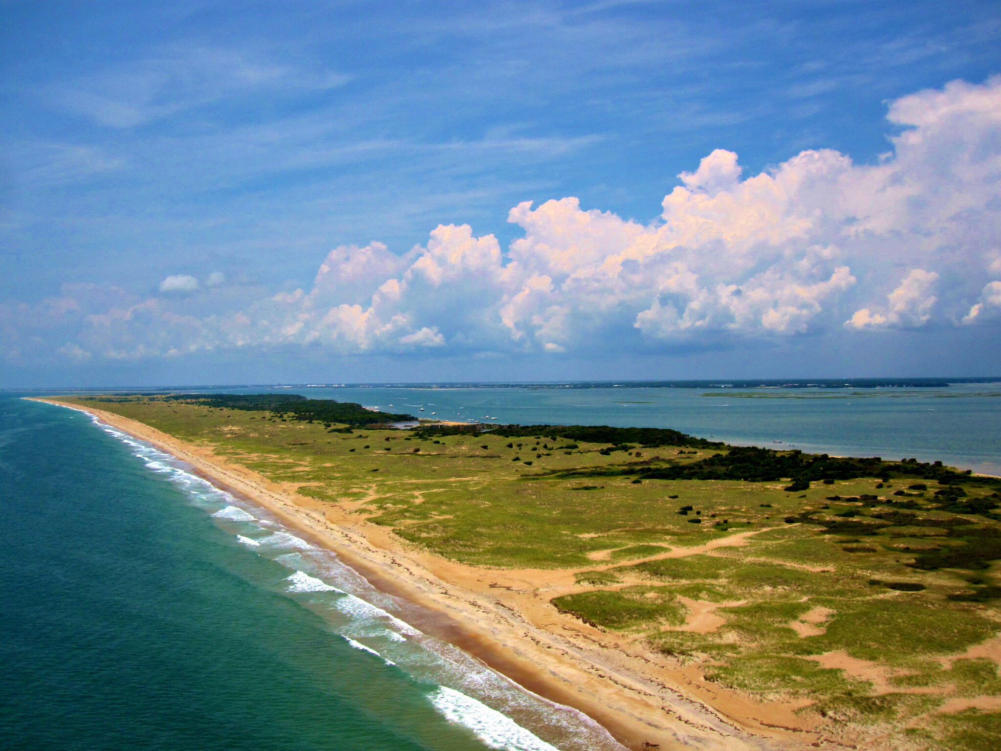
North Core Banks, Wilber’s Creek–south of Cricket Island
Story


do you know more? contact me.
Wib’s Community
“Wib’s” or “Wib’s Creek” refers to this area due to Wilbur Nelson who had small. simple camps on the “ridge” and a house alongside the road down near the water. Contemporary Bankers use this name for the area but it had two names prior. Before Wilbur, it was called “George Hill’s” after the first known (as of now) person to build a camp there. That structure was destroyed in the 1933 hurricane. Preceding his ownership, it was called Styron Hills after a prior owner in the 1700s (Clay Fulcher had documents showing this).

The base of the George Hill chimney hidden in overgrowth is all that remains of his cabin. Three U.S. Geodetic markers are also at this site according to Clay Fulcher. George Hill, of Hunting Quarters/Atlantic, had the first known structure at the Wibs area. He had deed and ownership, He built near the head of the creek, later to be the Fulcher “little camp”.
Located across from Atlantic, N.C. and reached from channel marker #13 and then following sticks marking the channel, the community dock could most often be reached. If weather or tides blocked that route, the crowd would use the Morris landing or even another site inside the inlet and the drive up. The Park Service deconstructed most of the dock.

Remains of the dock in 2021 during an outing with Clay Fulcher. Houseboats would often tie up to the north side.

Substantial boats could make it into the dock. Clay Fulcher, Jr.’s boat is seen here. (from collection of Clay Fulcher, III).
Locals could bring 20 to 30 foot run boats to the dock.
Wibs sister–Madge Nelson–had ownership of the area and everyone along the road had a 99 year lease agreement with her.
Starting up the remnants of the road from the shore. Camps were located along the left or NE side of the road in the section near the dock. As the road moves further in, it crosses a wetter area with marsh on either side and the road slightly higher. A pipe was paced between the road to allow water to flow under the road to either side.
Cabins were in two clusters. The areas nearer the dock and head of the creek was significantly higher and several houses were built in this area over the years, including George Hill’s initial home. The chimney still remains at the George Hill site.
Here also lie three geodetic mush-markers in a triangle. One lay under the edge of Clay and June Fulcher’s “little cabin” and the other two in the yard.
A well here provided water for washing and non-cooking or drinking use. The best water on the banks, by report, came from an additional well up and just over the ridge and to the south but within the community. It could provide good water up to 15 gallons at a time.
These cabins in the marsh side sat on land that Clay Fulcher believed George Hill had purchased from Theodore Rogers and that were, in modern days, part of a lease from Madge Nelson. Some of the cabins on the ridge were part of another ownership/lease situation–allowing the owners 7 years longer use than the 25 years others obtained for use. Those that put in claims and “fought” the process obtained limited continued use but those who did not put in claims lost their camps early in the NPS takeover.
There were some negative emotions and events by some who were angered by their loss while others retained theirs. This was true up and down the banks and on Shackleford.

Dr. Kendall also shared use of one of the camps at times.

The Wib’s area is at the left edge of the map–see the cluster of fishing shacks further up the road and near the center of the banks.

From the air, showing cabins alongside the road at Wib’s Creek.
This community reinforces the existence of the “lost” story of the cabin culture of the Banks. This has been found true also on Shackleford Banks and oral history there. These were nice homey cabins with variable but existent ownership or leases for many. Wib’s/Webb’s was like a little community–families gathered, made ice cream, connected.
Superintendent McGee had the road repaired after damage occurring with camp removals. An offer to re-build the dock was declined by Charles Perry Styron’s family, wanting to avoid having outsiders moving thru their asrea.
Beginning from the beach and ridge toward the creek, an outline of camps follows:
WILBUR NELSON (WIB’S) RENTAL CABINS —————
There were four or five (up to eight by some history) of these positioned along the “ridge”–these were simple structures for fishermen to rent having shed roofs with simple interior. Nelson brought camper’s cars over to the landing by pulling them on a barge.
Joe Fulcher relates that the Frank Nelson camp was built from one of these cabins that had blown over into the marsh area alongside–it was righted and elevated to become the core of the cabin they built.

SAMMY MASON CAMP —————————–
Clay Fulcher believes Sammy built his camp about the time that Frank Nelson and Darryl Willis established their camps.
The camp was used by 4 generations including Perry Styron and Kara Jo (Sammy’s sister), Charles Perry Styron and Cindy, and others. Thought to be part of the Hamilton tract, the family was able to extend ownership seven years longer than others at Wibs.


FRANK NELSON’S CAMP——

Joe Fulcher remembers Frank Nelson camp. A small ridge is seen in the distance toward the beach–no high hills in area however. Darryl Willis’ camp is seen behind the Nelson camp.
8-4-20 interview.
Jack Rose’s Camp ————
Jack , of Sea Level, a commercial fisherman who later worked at Cherry Point, hunted with Clay Fulcher on the banks for 30 years and had a close connection with Clay and the Banks. He and family used the camp Spring, Summer and Fall and then intermittent winter hunting trips. His wife Delores, nicknamed “Ping”, his sister, and extended family all loved to go over to Wibs’.
Jame’s camp was the first on the marsh road after you came off the ridge.

JAMES RAY WILLIS ———————————————————-
James Ray hunted with Lambert Morris at Merkle Hammock. He took over Lambert’s garage camp for a while before moving down to Wibs. He stayed a Wibs old house after abandoning the Merkle Hammock site. He tore down Wibs old house and built there. He often stayed there alone.

CLAY and JUNE FULCHER ————————————————-
They called this their “little camp” in distinction with” the bigger family camp about a mile north, the “big camp”, now named “Pilentery”.
This camp was perfect for them and their own family. The sense of community, the easy access, the ability for the kids to ramble, and a great get-a-way for all.

Freddy Hooper—————
Freddy,s camp was the first structure nearest the creek.

WINKY ROBINSON ——————————————–
Winky built the camp nearest the shore of Wib’s Creek on a small rise. Seen on the preceding aerial photo of the area, the location can be clearly seen. It was one of the first cabins in the area in the current era. The camp was bought by Freddy Hooper.
The NPS Long Point Cabins were destroyed by storms and a replacement sites been chosen in the Wib’s area. Clay Fulcher spoke several times of the stability of this area of the banks and resistance to over-wash. Google maps shows the area under consideration.

See individual camp pages for more on each of these camps and owners.
Credits
- Clay Fulcher, III–Atlantic
- Charles Styron, Atlantic
- Joe Fulcher, Morehead City
- NPS archives and files
- Other references within text