The Beaufort Connection to the Southern Outer Banks

“Beaufort is the Gateway to the Outer Banks.” –Glenn Adair told a News and Observer reporter in 1957. He added–But, to the discerning visitor, Beaufort is the end of the rainbow. Why go to the Outer Banks?”
{{The Southern Outer Banks stretch from Ocracoke to Emerald Isle–this research blog has focus on the Banks included in the Cape Lookout Seashore. Beaufort as a Gateway–the seaport of Beaufort was a favorable jumping-off spot to reach the Southern Banks due to its proximity. Also, Beaufort and eastern Carteret County was always physically, spiritually, and functionally linked to these “sandy islands”}}

The stories of Beaufort and the Banks have been intertwined for well more than three centuries.

Charles and Cindy Styron spent their honeymoon in their family cottage on North Core Banks. While I carved geese and redhead decoys for him, Charles shared the multigenerational story of their family camp and expressed how precious it was to them. The family had owned more than 3,000 acres on the Banks earlier and, still retained rights in the 1970s. They obtained a lease when the Park acquired family properties.
The Styron Camp (click topic to see more) was one of four hundred (400) structures–second homes, clubs, cottages and camps existing on the Southern Core Banks in 1976 when the Park Service took over.

Charles mom hand-painted the cupboard doors of the cottage.

These were not “just squatters and fish shacks” as some have said of them. Being special to them– as repeatedly shown to the author, locals have in their mainland homes artwork depicting their camps .

Keeping their camps close to heart even when not there.
The Styron Camp story led me to explore the larger story–the culture of these camps during the last 100 years before the Cape Lookout National Seashore was created. A big story–with each camp having a rich story of its own. Wib’s Creek (click topic to see more).
I am “from off” and this is not my story but these are stories I do not want lost–of resilient and courageous people, self-sufficient, and resourceful. Though the camps are gone now, these Bankers still have their spirits rooted in this sandy soil.
Beaufort has been interwoven with the Banks story–much of it even pre-revolutionary. Therefore, first, please allow me to present some of the early Banks history, much directly related to Beaufort.
Native Americans

In 1585, English explorers found 85 members of a tribe calling themselves the “Croatan” living at what we now call Cape Lookout. Their name for the site was “Croatan”.
“CROATAN. A village in 1585 on an island then called by the same name, which appears to have been that on which C. Lookout is situated on the coast of Carteret Co., N.C. The inhabitants seem to have been independent of the chiefs of Secotan. It is thought that the lost colony of Lane, on Roanoke id. joined them and that traces of the mixture were discernible in the later Hatteras Indians.– (1)
Our Revolution—and the Banks


Fort Hancock –1756 map showing planned position. The fort was built during the revolution by French allies and manned by militia from Beaufort and the surrounding area. No remains are currently findable.
Last Revolutionary Battle


Beaufort was invaded and plundered for supplies, but later the invaders were repelled by local militia on Shackleford Banks when they attempted to re-water the vessels.
(The Researcher–Fall 2008–published by the Carteret County Historical Association in Morehead City–contains the entire article.)

1764, HMS Viper documented early “whaling huts” along the Shackleford shore–early Bankers watched from shore for whales. The oil was brought to Beaufort to trade for essentials not available on the Banks.
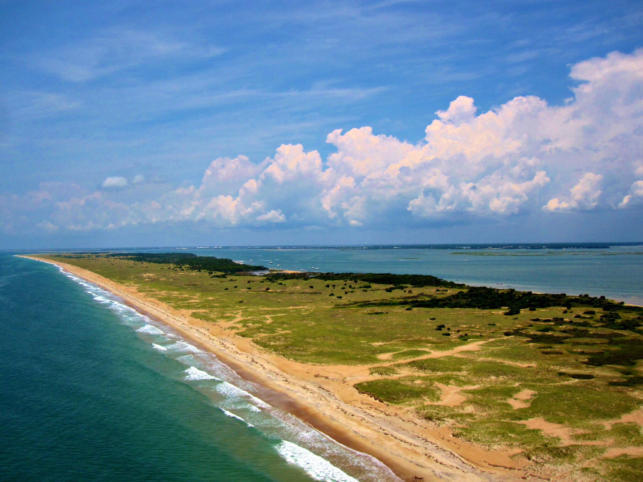
Early Use of the Banks–the “Sandy Islands”–

Besides obtaining harvest from the waters, the Banks were used until the 1970s for livestock. This is a 1970s photo.

Teams of mullet fishermen, many who were farmers were there during non-productive farm seasons, they caught-cleaned-salted-barrelled and transported mullet for sale. Receiving a share of profits, this supplemented their farm income. Collier Cobb reported on these fishermen in National Geographic.
Fish Towne–Beaufort was a hub that bought and sold seafood to the region

“the inhabitants seem miserable, they are very lazy and indolent”,

Communities grew up along Shackleford (click topic to see more) and South Core Banks –which were one island until the 1933 storm. Self-sufficient Bankers were connected to Beaufort for sale of their harvest and for supply of their needs.
English explorers in 1709 referred to the Banks as “Sand Banks” or “Sandy Islands”–where John Lawson listed forty-one types of fish and eighteen types of shellfish found along the coast–harvests described as useful as food or useful for some derived by-product.

The term “progger” was given to those ready to harvest whatever was in season and what opportunity presented that day. Gardens, livestock and their harvest from the creeks and marshes was supplemented by a couple of whales yearly. Shackleford Banks was know for respected boatbuilders as well.

Photographs of communities on the Banks have not yet been discovered by the author, but Jack Dudley’s book shows a photo of Rose Town at the Cape area. It is reasonable to think the communities would have been similar.
Other examples of Banks connections include:


Sam Windsor’s Lump (click topic to see more)

Sam Windsor (not Winter) was given 50 acres on the Banks near Whale Creek, to allow him to be self-supporting as a freed man. His descendants were connected with the Queen Street School and Beaufort baseball team (where descendant Sam Windsor was legendary).

Sailing to the Banks, usually to Tyre Moore’s area, worshipers would stay on the Banks for days or weeks–coming from Beaufort and Down East–they rafted the boats together to make a “pier” to get to shore.


Artwork depicts community on the Banks. The photo of the Gaskill family leaving the Banks after the 1896 and 1899 storms and a Park Service photo labelled as Diamond City showing a lady on the porch are all the photographic history of Diamond City (click topic to see more) currently in hand.
What seems a relatively large number of full-time residents had all exited by 1905. Joe Lane Lewis is likely the only full-time resident on Shackleford Banks following the “Exodus” to the Morehead City “Promise Land”, Beaufort , Harkers Island and Salter Path. Many homes were floated to their new mainland sites.
Spiritual ties remained–rooted in the sandy soil.


Wade Shore Cemetery can still be found. It was one of at least five cemeteries on Shackleford Banks. The largest, sometimes called the Ben Rimes Graveyard at Diamond City, held 400 graves by some reports.
Though some graves were re-opened and moved with the families, most of those leaving left family behind–many left were connected to Beaufort, like the Moore’s and Lewis’. Shackleford Cemeteries (click topic to see more).
Staying Connected–

Having Dinner at Home–more… (click topic to see more)
Nina’s family included Charlie and Nettie Lewis who, in the 1933 storm, lost their home at the Mullet Pond. They were part of many generations of Lewis’ living or connected to Shackleford Banks.

Joseph stayed for the 1933 storm, eventually lashing himself to a tree to survive–the family says he was “never the same” after that.

Charlie Lewis (click topic to see more) built a new structure along Wade Shore in 1934 to replace their lost site. Charlie and friend Ghermann Holland (click topic to see more) each had fish houses in Beaufort. Ghermann bought the property after Charlie’s death. Ghermann was the sheriff for many years and involved in Beaufort business and government also . The camp is more often referred to as Ghermann’s camp or the Holland camp.

The camp was shared with and loaned to many friends, but was also used for the Marine Science School as a dorm.

The “Beaufort Beauties” at Ghermann’s camp in 1953.
From left, Patsy Sadler, Virginia Hassell, Sylvia Harrell, Joyce Chadwick, Bobbi Dennis, Charlene Harrell and Barbara Pinner.
What impact can nature have on individuals?
Watching for migrating shorebirds near her family cottage inspired a career protecting wildlife–says Melissa Moye, Chief Financial Officer for World Wildlife Fund. The moon sits above “Casablanca” where Moye was impacted.
Joel Bourne spent time at a cottage in Lookout Bight–originally the 1915 Josenhans Cottage–known in the 70s as the Bourne Cottage. He is writing a memoir about his times there.

Baker-Holderness House–“Casablanca”— and the Moyes (click topic to see more)
Josenhans Cottage–Bourne Cottage (click topic to see more)
Beaufort Locals-—

Every camp or cottage has its own story–or multiple stories.
Camps were “get-a-ways” for some–family second homes for others, sites for “peeler camps”, hunting or fishing–they also served often as “harbors of refuge” from weather. Life on the Banks offered simplified life, guided discovery for youth–places of family bonding. Those on the banks were self-sufficient but also had a network of support from others there.

Dr. Laurie Moore (click topic to see more) was a beloved physician in Beaufort. A descendant of the Tyre and Polly Moore of Shackleford, he obtained the decommissioned WWII Coast Guard shack and moved it to Whale Creek.
Going to Whale Creek for a “get-a-way”, Dr. Moore would often awake for coffee to find a line of patients lined up on the porch–they knew where to find him. There are numerous stories of his generosity and concern for those he served.

Judy Spitzbergen, Dr. Moore’s daughter was a leader in the Carteret County Schools and Maritime Museum partnership to develop a Marine Science curriculum for students grade 4 to 12. Juniors and seniors spent weekend field trips on Shackleford to learn and do individual research projects.
Dennis and Judy Spitsbergen met there–Dennis was a chaperone for the guys dorm–Judy, the gals–using the Holland Camp for one dorm. (seen above)
Judy later became the first paid director of the Beaufort Historical Association.

Jim Rumsfelt, who lives on Front Street, was a student in the Marine Science program and also spent time at his grandfathers camp.
Edna’s Camp—Edna Heslep-Bjerke (click topic to see more)

Ms. Edna’s Camp was shared and loaned to many locals–Bob and Mary Austin, Opal Hill, the Lewis’, Chris and Arlene Sabiston and others.

Almost every cabin’s story includes sharing it with many others–easily 25 people or more each–400 camps–generates 10,000 camp experiences in a small local population. Almost all those raised here locally ( especially Beaufort and east) have a story of experiences at one of these camps.
The recurring story is that of leaving their structures unlocked, knowing it might be needed by someone for refuge from weather–harbors of refuge.
Roy Eubanks, (click topic to see more) well known photographer of Beaufort, took this photo of the early Core Banks Club on South Core Banks. He worked with Aycock Brown at the Beaufort News–both of them photographers–much along the Banks was documented by them.


For $600, Eubanks purchased the decommissioned Portsmouth Coast Guard Station which he rented as a fishing/hunting camp to Charlie Vellines.
Vellines was a WWII Corsair pilot and flew often over to the Banks. He often took along Beaufort youth to fish with him on the Banks. Once, leaving the Banks almost empty-handed, they spotted fish caught in a receding tidal pool and re-landed. Frantic fish wouldn’t bite, so Charlies herded them toward the youth ready with man-made spears to impale the fish. Successful, they flew home late, and not unlike the movies–had parents lined the runway with car headlights to allow landing. He named this young band of fishermen- a name caught by the Raleigh News-Observer–as the “The Fabulous Flying Fishermen”.

Vellines (click topic to see more) kept the new name as he flew many on similar adventures–including Governor Luther Hodges (2nd from right) and Grady Sheets (R), who taught Ted Williams how to fish for Drum.

Sailing to the Banks, usually to Tyre Moore’s area, worshipers would stay on the Banks for days or weeks–coming from Beaufort and Down East–they rafted the boats together to make a “pier” to get to shore.
Sense of Community

Along Shackleford Banks at sites like Bell’s Island (nicknamed Little Miami due to density of camps), Bald Hill Bay, Wib’s Creek and other sites–families gathered to enjoy the experience. Adults played baseball alongside youth, they fished and explored together, cooked-out, rode three wheelers–a variety of shared experiences existed.


Asa Buck remembered his wife spending weeks at a time over “to the Banks” while he was on the mainland–like Asa, many husbands commuted back and forth.
Hunters and Decoy Carvers–Market Hunting-Hunt Clubs
Ducks-Geese-Shorebirds-Loons-

Recognized by North Carolina with a Folk Heritage Award for his decoys, Jule Hamilton (click topic to see more) had one of the best known hunting camps south of Portsmouth –called Evergreens.


Julian Hamilton, Sr. (click topic to see more) was a decoy carver and hunter as well. Julian, Sr. had a home on Ann Street while June had a Marsh Street home–both raised waterfowl in their backyards.
After WWII service, Julian owned property with Wilbur Nelson on North Core Banks and later shared Evergreens with Jule. Julian would sail the extended journey to his camp
James and Belinda Mason-–

James Mason (click topic to see more) bought land from the state for 25 cents an acre on North Core Banks in 1859. He and Belinda lived on the Banks site. Capt. Mason’s schooner was anchored off the sound shore. He later sold several parcels to Theodore Rogers (President of the Bank of the Metropolis, Manhattan). Captain Mason built the initial Pilentary Club for Rogers, along with a spritsail skiff.
About 1878, the Mason home, located north of the club, burned and James and Belinda moved to Beaufort to live in the Hammock House. Son, Augustus, lived in a home nearby.
The Pilentary Club (click topic to see more) was the most grand of the Banks cottages and clubs. (seen above right–art rendering by Ken Humphries).

After Roger’s death, foundry owner Jordan Mott purchased the club at which he later entertained F.D.R.
Like most hunters coming from the north, the path to the Banks led thru Beaufort. F.D.R. toured the Old Burying Grounds while here.

Only the chimney remains standing on Rush island across from Shell Point.
Edwin Binney (click topic to see more) used Beaufort as a jumping off spot to reach his Nine Islands Club (early 1900s) across from Harkers Island. Binney invented crayons and dustless chalk for schools. His daughter Dorothy flew many times with close friend Amelia Earhardt. Their friendship ended after Earhardt married Dorothy’s ex-husband.
Horse Pennings (click topic to see more) till the 1970s–

Locals, including those from Beaufort, participated in the twice-yearly horse penning–actively or as spectators.
Dr. Fulcher—

Dr. Fulcher (click topic to see more) built a camp in Cape Village after his wife found a snake curled up with their sleeping baby while at a Shackleford camp (as told by his daughter).
Dr. Fulcher bought Banks horses and put them on Carrot island–now they are enjoyed by tourists and locals alike..
Change comes—

The concept of a National Park along the outer banks was circulated in Congress in 1934. Frank Stick seemed the prime mover (son, David Stick wrote much about the outer banks history). The initial vision was a park stretching at Kitty Hawk or above and down to Fort Macon and part of what is now Atlantic Beach.
Cape Hatteras Seashore was established first, later followed in 1966 by the establishment of Cape Lookout National Seashore . Unfortunately for these Banks camps, Congress mandated the area in the new seashore be returned to a wilderness status.


It was a big job—-3,500 abandoned vehicles littered the islands. Cattle, sheep, goats, pigs and horses roamed free. Trash piles had accumulated. There was much that could be improved, but return to wilderness meant that most cabins could not remain.

The debate still occurs locally–“cars promoted establishment of dunes better than stacks of Christmas trees”, locals say. Abandoned vehicles were a local strategy to build dunes and break the force of any over-wash.


The most painful part involved the removal of these 400 lstructures–valued, loved, multigenerational–precious to many.
Emma Rose (click topic to see more) says sincerely–“I wish I could have chosen, I would rather they had burned my home on Harkers Island and let me keep my camp”.

“The boys” decided that if they could not have their camps, then nobody could–in the night, the camps of Dr. Moore , Edna Heslep. and Ghermann Holland (who all had leagal leases based on deeds and litigation )were burned through arson. The Park Service office was also burned the same night.
A coalition of fishermen were successful in preserving beach access for fishing and establishment of two Park Service rental camps.


It seems clear that we are fortunate that attempts to develop (click topic to see more) the Banks did not succeed. They would be , we now see, unsustainable, but more important–we would not be able to experience these same Banks much like the 1585 Indians and early settlers experienced them. —
The Cape Lookout Development Company had planned (early 1900s) to extend a railroad from Lennoxville Point across to Shackleford and east to the Cape– where plots were to be sold. Repeated attempts at development occurred in the 1930s and 1970s.

The Cape Lookout Seashore is genuinely excited to support this author in capturing and preserving this story of a special place and a valued culture. I am thankful to them and many others.
(1) Handbook of American Indians North of Mexico–edited by Frederick Webb Hodge–Smithsonian Institution, Bureau of American Ethnology-Bulletin 30–Washington–Government Printing Office 1907
(2) NPS Archives and files
Leave a Reply to shady4ffb8559a5Cancel reply