
A Spiritual Touchstone for the culture of the Banks and Downeast–

Curt and Martha Salter, most every evening, would drive down to Shell Point at sunset to look across Barden’s Inlet to the touchstone of their lives. Like the rhythmn of a porch swing, the pulse of the Cape Lookout Light was a precious part of their day. Others, like Coery Lawrence, lament even the change away from the sweeping light that he and others grew up having as constant night-time companion which was replaced by an intermittent flash—but still its companionship is cherished.
In earlier days, through the windows and from the porches (“pizers”) of Lookout Woods/ Diamond City and of Down East homes, the 1859 lighthouse stood and still stands sentinel– (1859-2025/ 166 years/over 60,000 nights)– the light stood in their view as their constant—seen by family and friends, but just as importantly, by generations of their ancestors who were surf men, whalers, fishermen, proggers, soldiers, sailors, navigators, Revolutionary militia, Confederate and Union soldiers, surf fishermen, German subs, jetty workers, or a hundred vessels in an anchored convoy at the Bight (though then a darkened sentinel in the blackout)….there she has stood.
Cape Lookout Lighthouse is a symbol of the Cape Lookout National Seashore, but it is much more. This Lighthouse is a spiritual touchstone to thousands of locals who have lived with this light providing a wonderful pulse throughout their lives.
To read more deeply about the Cape Lookout Lighthouse and its history, click the link below:
[a “progger”..someone who adapts in their search for daily -foraging for -whatever food or income source would sustain them–fish, oysters, clams, waterfowl, loons, whales, scallops and more—-going out each day to harvest whatever nature’s cycle made available for their survival–adaptive, resilient, self-sufficient–a trait of Bankers}
Find Out More About the 1859 Lighthouses
The Historic Structure Report for the 1959 Cape Lookout Lighthouse is available at the link below: –explore detailed history of the Lighthouse…
https://npshistory.com/publications/calo/hsr-cape-lookout-lighthouse.pdf
Before the Light came to the Cape, navigation was dependant on charts and reckoning.
In the 1700’s, the only naviagation landmark was the 50 foot flagstaff of Caleb Davis’ “ordinary” (a two story structure providing bed, board and tavern on the Bight of the Cape). From scattered sources, it appears that the remains of Fort Hancock also persisted there until the early 1900’s. But on the Cape, most landmarks then consisted only of naming the larger dunes or of the “cuts” in the waters. These low-lying structures likely helped define entry into the Bight but did nothing to provide safety to vessels skirting the Lookout Shoals.

Lookout Shoals... “Promontorium tremendum” (“horrible headland”)
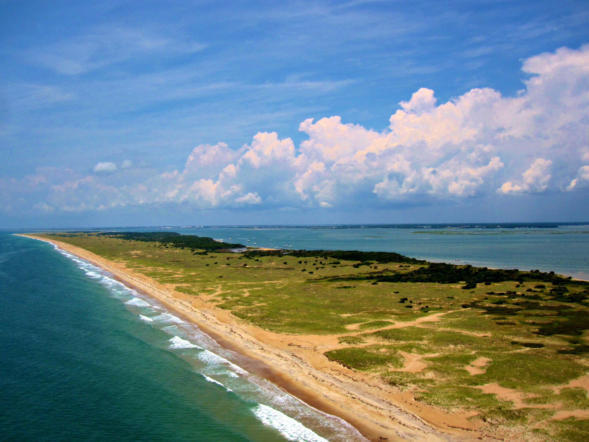
Early explorers and those since have found the southern tip of Core Banks to be a significant hazard to navigation. Cape Lookout shoals extended ten miles southeasterly from the point of the Cape. The Cape Lookout Breakers, three quarters of a mile long and as shallow as two feet was located mid shoals. Strong currents and powerful storms converged here to exaggerate the danger. The low elevation of the land mass along this segment of coast gave little warning of the proximity to these dangers.

Referring to the importance of our lighthouse:
“In consideration of the manner in which
navigators have to follow this low coast,
this light becomes, necessarily, one of
the most important sea-coast lights,….”
“The shoals off this cape are
of such character as to render it a very
important light.”–the Lighthouse Board, 1800s
The initial 1812 Lighthouse–failed in its mission
The 1812 Lighthouse proved inadequate and was replaced by the current lighthouse in 1859. Stones from the 1812 foundation can be found a little north of the current light. (for more info on the 1812 Lighthouse–click the red highlighted heading above)

The 1847 edition of The American Coast
Pilot stated—–
“Cape Lookout Lighthouse is painted
red and white stripes horizontally and
can be seen 16 or 18 miles and
represents a ship under sail. It
contains a fixed light, elevated 100 feet
above the level of the sea. The house
is surrounded by a small growth of
trees, from which a bold sand beach
extends in a S.E. direction, about 3
miles, in the centre of which are small
hillocks of sand. This light, although
seen clearly all night, until near the
approach of day, cannot then be
discerned owning, it is thought, to a mist that rises between the vessel and the lamp. It is judged imprudent to
approach the shoals of Lookout in the
night nearer than 7 fathoms on the
east, or 10 fathoms on the west side.”
Lt. H. J. Harstene, of the U. S. Navy and
commanding the U.S mail steamer Illinois,
filed his complaint with the board and
articulated the hazard and frustration in his
letter to Lt. Jenkins on July 18, 1851, when
he wrote, “The lights on Hatteras, Lookout, Canaveral and Cape Florida, if not improved, had better be dispensed with, as
the navigator is apt to run ashore looking for
them.”
1859 Lighthouse —- came to the Cape

1859 saw completion and change-over to the taller structure with improved light range–red in color at that time.

A DETAILED HISTORY of the 1812 and 1859 Lighthouses can be found in the two links below--click to explore
Cape
Lookout Lighthouse Historic Structure Report
https://npshistory.com/publications/calo/hsr-cape-lookout-lighthouse.pdf
Gateway to the Atlantic World
The community of Lookout Woods (400-500 Bankers at one time) existed on the eastern end of Shackleford Banks. In addition to the role of a navigation aid, the Lighthouse put them to bed each night and kept them company when they sat on their porches in the evenings. The Light became important enough to them to cause their change of the community’s name to “Diamond City” soon after the re-paint of the Lighthouse from red brick to black and white diamonds (1873).


Additional photos and media are contained at this additional link-click to view
Cape Village clustered between the Lighthouse and the Life Saving Station Station was home to the keepers and their families and the families of surfmen and later Coast Guardsmen. Having a school and Post Office and several stores, it supported 80 or so year-round residents. With advent of motorized vessels, automation of the light and reduction of necessary Coast Guard personnel, the community around the Lighthouse withered away. Already, the San Ciracao storm in 1899 caused nearby sister community, Diamond City, to be abandoned within a few years of the storm and the Village also became a “lonely place” by 1916–only essential crew and seasonal fishermen remained.
Some historic structures still remain but homes from the early 1900s are few. (Click red link above to see 1966 structures remaining)
War Came to the Lighthouse–
The Civil War and World Wars I and II saw the Cape and her Lighthouse involved:
The Lighthouse was under initial Confederate hands ( who darkened the light and removed the lens) before Union control–Union forces relit the light using an inferior replacement lens–in support of the blockade efforts. A Confederate raid damaged but did not disable the light. (more details available on the links below)

Excerpt from Scatterwood letters:

Read more details about the Civil War and the Lighthouse in the Historic Structure Report–click link below–page 16
https://npshistory.com/publications/calo/hsr-cape-lookout-lighthouse.pdf
The Cape and its Lighthouse played a role in each war–Lookout Bight gave safe harbor to convoys as large as 100 vessels each night–(click red link for more details).
The light went dark for the mandated “Dim Out” but observers manned the Lighthouse railings watching for submarines. The lightship LV-107 returned to monitor vessels coming to the critical Harbor of Refuge.
click red link above to explore more

Keepers of the Light—
Issac Willis, just one example–


Additional details regarding the Keepers are found in Gateway to the Atlantic World, starting page 136 —click link below—
Cape Lookout Lightships—
(lightship–“a sea-going vessel designed to function much like an earth-bound “lighthouse”)
A lightship was added to define the position of the shoals–1905-1933–returning in 1942 to help with harbor defenses


1933–lightships were replaced by Cape Lookout Bell Buoy and improvements in the Lighthouse
Threatened by Mother Nature–

Always enduring the repeated hurricanes and severe storms, and facing harsh environmental elements, and even surviving the Confederate attempt to destroy the lighthouse, the biggest challenges were yet to come.
The 1933 un-named storm opened what we now call Barden’s inlet and the choice made to prevent its natural closure brought a repeated forceful flow of tide exiting the sound with resultant erosion of the eastern shore of the Bight alongside the light. Seemingly, an overwhelming battle to preserve the shoreline and nearby structures—lighthouse included—seemed futile at times. Initial plans to abandon the lighthouse seem to have been met with strong public disagreement. Dredging…then and now… is needed to sustain a healthy sand barrier for the lighthouse and supporting structures—most recently completed in 2024.

Impact of the elements of moisture and salt upon the structure was escalated by mistaken maintenance choices that trapped moisture inside the structure and also did not allow the bricks to release trapped moisture. Internal ironworks and brick/mortar deterioration brought disastrous changes. (Details are found in the Historic Structure Report for the Lighthouse--link above)


Traffic within the lighthouse, meant to have been the modest foot traffic of keepers, now became a sought-after visitor experience and visits to the top of the light took their toll.
The Park recognized the value of the lighthouse and the need for its preservation as a visual icon and a visitor attraction. The precious value to the Banks and Down-east culture is now well established. Contribution to the local economy by the Cape Lookout National Seashore has been substantial. Funds for dredging and structural restoration were eventually obtained through the slow governmental channels and the Cape Lookout Lighthouse seems poised to survive the foreseeable future—with expectation of future challenges always on the horizon.
…………………….(see the link describing progress on the restoration process–link is below at end of the blog)
“The erosion on the north side of the Bight
caused by Barden Inlet became increasingly
threatening. In September 2003, only a few
months after the National Park Service had
taken over control of the lighthouse,
Hurricane Isabel struck and eroded the
protective dunes on the sound side and
destroyed the coal shed. By 2006, the
erosion required intervention if the site was
to be preserved. In January, the Park Service
announced a program to replenish the sound
side beach with sand dredged from a shoal
northeast of Shackleford Banks.”–NPS document
More details about tidal forces——-
The erosion risk seemed even worse in earlier years–
Erosion has been an ongoing problem–the outgoing tide cuts into the shoreline of the Bight–past and recent dredging and shoreline “nourishment” is a fight against the twice-daily tidal effect.

Loss of the Lighthouse once seemed inevitable —??—1979
The new Cape Lookout National Seashore was charged by Congress with competing goals–return the Banks to wilderness status while maximizing reasonable use by citizens.
President Johnson signed the 1966 bill to establish the park and 1976 saw the beginning implementation. The Park Service, with citizen advocacy, came to realize the value of and make substantial commitments to preserving the Lighthouse and associated historic structures. But the start apparently was shaky……
Though the Lighthouse now is a recognized key asset of the Park–as evidenced by dredging to create a sand buffer from the relentless attack y tides and the multimillion dollar renovation underway–there was an earlier close call in decision making…see below…


The new Park finds its footing...
It became quickly clear that the Lighthouse was a valuable cultural asset, an icon of the Banks culture and a keystone for the new Park. Any debate is long past and commitment to the Lighthouse has been consistent for decades.
Cape lookout National Seashore contributed $32,033,000 to the local economy this past year–the Lighthouse and Keeper’s Quarters greets many of its visitors.
The Voice of Locals–continues to have value…..
“In June, 2003, the Coast Guard turned over
control of the lighthouse to the National
Park Service while retaining operational
control of the light. On the day the
lighthouse opened to the public, the crowds
were unprecedented. More people ascended
the tower’s stairs in a few days than had in
the previous one hundred-plus years. In
addition, the following year a Coast Guard
survey of the public regarding the quality
and usefulness of the light revealed a strong
public appreciation for the lighthouse far
beyond its initial purpose. Clearly, the
lighthouse has become an important local
attraction as well as a navigational aid.”–Park document
Historical Significance added additional motivation for Preservation—-
“Constructed between 1857 and 1859, the Cape Lookout Lighthouse is significant as the prototype of all lighthouses to be erected on the Outer Banks of North Carolina. The Cape Lookout Lighthouse was the first of the great lighthouses erected along the North Carolina coast by the U. S. government during the mid-nineteenth century replacement of earlier, smaller lighthouses. The lighthouse was given a distinctive black-and-white-diamond pattern in 1873. It is a contributing resource to the Cape Lookout Light Station, which was listed in the National Register of Historic Places in 1972 as an important physical and historical maritime feature of the nineteenth century development of the Outer Banks. The lighthouse is also a contributing resource to the Cape Lookout Village Historic District, which was listed in the National Register of Historic Places in 2000. The district, which contains twenty-one principal resources, is anchored by the Cape Lookout Lighthouse at the north end and by the former U.S. Coast Guard Station to the south. Sixteen of these resources the lighthouse, the life-saving buildings and structures. the circulation network. and the historic landscape contribute to the district’s significance as a unique Outer Banks community that flourished as a fishing village and life-saving station from the 1870s to about 1920, and then endured as a resort for hardy vacationers until becoming part of the Cape Lookout National Seashore in 1966. “(from the Historic Register document content)
Lighthouse Renovation-–Underway
Cape Lookout Seashore proudly has announced a major restoration project for the Lighthouse that is currently underway. Recognizing the cultural value to visitors and to coastal citizens –and to its service as a symbol of the important Southern Outer Banks history and community connections–this long awaited renovation has begun. Follow the progress of the work by checking the link below:
https://www.nps.gov/calo/learn/news/cape-lookout-lighthouse-restoration-project.htm
additional resource—
https://www.nps.gov/calo/learn/historyculture/civil-war-lighthouse.htm
The Diamond Lady will soon stand refreshed again– strong and proud– watching over the sea, surf and sand, an us.

Leave a Reply